File:Emae - NASA Image.jpg

Size of this preview: 800 × 528 pixels. Other resolutions: 320 × 211 pixels | 640 × 423 pixels | 992 × 655 pixels.
Original file (992 × 655 pixels, file size: 478 KB, MIME type: image/jpeg)
Captions
Captions
Add a one-line explanation of what this file represents
Summary
edit
| Description |
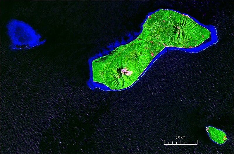
English: Geocover 2000 Satellite image of Émaé Island, Vanuatu, Pacific Ocean |
| Date | |
| Source | NASA World Wind screenshot |
| Author | NASA |
Licensing
edit
| This image is in the public domain because it is a screenshot from NASA’s globe software World Wind using a public domain layer, such as Blue Marble, MODIS, Landsat, SRTM, USGS or GLOBE.
|
 |
File history
Click on a date/time to view the file as it appeared at that time.
| Date/Time | Thumbnail | Dimensions | User | Comment | |
|---|---|---|---|---|---|
| current | 16:31, 22 January 2011 | | 992 × 655 (478 KB) | Ratzer (talk | contribs) | {{Information |Description={{en|1=Geocover 2000 Satellite image of Émaé Island, Solomon Islands, Pacific Ocean}} |Source=NASA World Wind screenshot |Author=NASA |Date=2000 |Permission= |other_versions= }} [[Category:Satellite pictures of the Solomon Is |
You cannot overwrite this file.
File usage on Commons
There are no pages that use this file.
File usage on other wikis
The following other wikis use this file: