File:Emerald Mound from south.jpg

Size of this preview: 800 × 532 pixels. Other resolutions: 320 × 213 pixels | 640 × 426 pixels | 1,024 × 681 pixels | 1,280 × 851 pixels | 2,560 × 1,702 pixels | 6,016 × 4,000 pixels.
Original file (6,016 × 4,000 pixels, file size: 5.48 MB, MIME type: image/jpeg)
Captions
Captions
Add a one-line explanation of what this file represents
|
This is an image of a place or building that is listed on the National Register of Historic Places in the United States of America. Its reference number is 71001026. |
| Camera location | | View this and other nearby images on: OpenStreetMap |
|---|
| Description |
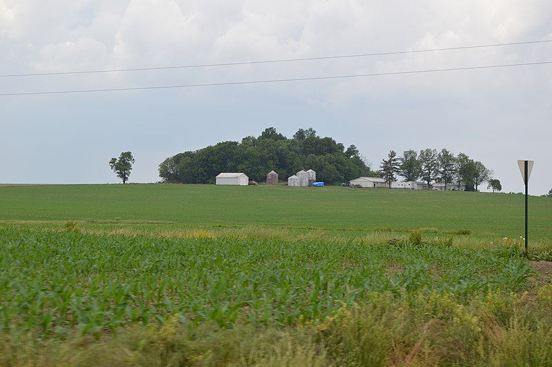
English: Distant view from the south of the Emerald Mound, a major Mississippian site located north of Midgley Neiss Road northeast of Lebanon in Lebanon Township, St. Clair County, Illinois, United States. One of the area's most important archaeological sites, it is listed on the National Register of Historic Places. |
||
| Date | Taken on 26 May 2014 | ||
| Source | Own work | ||
| Author | Nyttend | ||
| Permission (Reusing this file) |
|
File history
Click on a date/time to view the file as it appeared at that time.
| Date/Time | Thumbnail | Dimensions | User | Comment | |
|---|---|---|---|---|---|
| current | 05:22, 5 June 2014 | | 6,016 × 4,000 (5.48 MB) | Nyttend (talk | contribs) | {{NRHP|71001026}} {{Location|38|37|51|N|89|47|4|W}} {{Information |Description={{en|Distant view from the south of the {{w|Emerald Mound and Village Site|Emerald Mound}}, a major {{w|Mississippian culture|Mississippian}} site located north of Midgley N... |
You cannot overwrite this file.
File usage on Commons
The following page uses this file:
File usage on other wikis
The following other wikis use this file:
- Usage on de.wikipedia.org
- Usage on en.wikipedia.org
- Usage on es.wikipedia.org
- Usage on eu.wikipedia.org
- Usage on fr.wikipedia.org
- Usage on ur.wikipedia.org
- Usage on vi.wikipedia.org
- Usage on www.wikidata.org