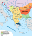
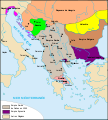
File:Empire de Dušan es.svg

Original file (SVG file, nominally 994 × 1,104 pixels, file size: 453 KB)
Captions
Captions
Summary edit
| DescriptionEmpire de Dušan es.svg |
Español: El imperio serbio bajo Esteban Dusan y los Estados vecino en el siglo XIV.
Français : Serbie de l'Empereur Serbe, Stefan Dusan.
Русский: Сербия при царе Стефане Душане.
Српски / srpski: Душанова Србија |
| Date | (UTC) |
| Source |
This file was derived from: Empire de Dušan.svg:  |
| Author |
|
| Other versions |
[edit]
|
| This is a retouched picture, which means that it has been digitally altered from its original version. Modifications: translated into Spanish. The original can be viewed here: Empire de Dušan.svg:
|
Licensing edit
- You are free:
- to share – to copy, distribute and transmit the work
- to remix – to adapt the work
- Under the following conditions:
- attribution – You must give appropriate credit, provide a link to the license, and indicate if changes were made. You may do so in any reasonable manner, but not in any way that suggests the licensor endorses you or your use.
- share alike – If you remix, transform, or build upon the material, you must distribute your contributions under the same or compatible license as the original.
Original upload log edit
This image is a derivative work of the following images:
- File:Empire_de_Dušan.svg licensed with Cc-by-sa-2.5
- 2006-11-23T09:09:11Z Le serbe 994x1104 (300196 Bytes) == Description == {{Information |Description=Empire_de_Dušan.svg |Source=own work (map template taken from [[:Image:Carte-Empire de Basile II.svg]]) |Date= 23/11/2006 |Author= [[User:Le serbe|Boban Markovic]] |Permission= |o
- 2006-11-22T17:09:22Z Le serbe 994x1104 (273861 Bytes) {{Information |Description= Empire_de_Dušan.svg |Source= own work by [[User:Nécropotame|Nécropotame|]](Carte-Empire de Basile II.svg) |Date= 22/11/2006 |Author= [[Utilisateur:Le serbe|Boban Markovic]] |Permission= |other_v
Uploaded with derivativeFX
File history
Click on a date/time to view the file as it appeared at that time.
| Date/Time | Thumbnail | Dimensions | User | Comment | |
|---|---|---|---|---|---|
| current | 08:39, 8 February 2017 |  | 994 × 1,104 (453 KB) | Rowanwindwhistler (talk | contribs) | Fake text |
| 19:40, 24 May 2016 |  | 994 × 1,104 (362 KB) | Rowanwindwhistler (talk | contribs) | New land layer | |
| 19:39, 24 May 2016 |  | 994 × 1,104 (348 KB) | Rowanwindwhistler (talk | contribs) | https://en.wikipedia.org/wiki/Wikipedia:WikiProject_Maps/Conventions Some shapes removed, white borders, city dots changed, some capital cities marked as such | |
| 09:05, 30 April 2016 |  | 994 × 1,104 (292 KB) | Rowanwindwhistler (talk | contribs) | Colours from http://colorbrewer2.org/ & https://en.wikipedia.org/wiki/Wikipedia:WikiProject_Maps/Conventions Some typos corrected. Some text moved to improve readability. | |
| 18:41, 21 May 2012 |  | 994 × 1,104 (291 KB) | Rowanwindwhistler (talk | contribs) | == {{int:filedesc}} == {{Information |Description={{es|1=El imperio serbio bajo Esteban Dusan y los Estados vecino en el siglo XIV.}} {{fr|Serbie de l'Empereur Serbe, Stefan Dusan.}} {{ru|Сербия при царе Стефане Душане.}} {{... |
You cannot overwrite this file.
File usage on Commons
The following 13 pages use this file:
- User:J budissin/Uploads/BiH/2016 April 21-30
- User:J budissin/Uploads/BiH/2016 May 21-31
- User:J budissin/Uploads/BiH/2017 February 1-9
- File:Dušan İmparatorluğu -tr-.svg
- File:Empire de Dušan-hu.svg
- File:Empire de Dušan-zh.svg
- File:Empire de Dušan.svg
- File:Empire de Dušan es.svg
- File:Empire de Dušan mk.svg
- File:Empire de Dušan pl.png
- File:Empire de Dušan pt.svg
- File:Taratul sarbesc.svg
- Template:Other versions/Empire of Dušan
File usage on other wikis
The following other wikis use this file:
- Usage on ast.wikipedia.org
- Usage on es.wikipedia.org
Metadata
This file contains additional information such as Exif metadata which may have been added by the digital camera, scanner, or software program used to create or digitize it. If the file has been modified from its original state, some details such as the timestamp may not fully reflect those of the original file. The timestamp is only as accurate as the clock in the camera, and it may be completely wrong.
| Width | 994.16998 |
|---|---|
| Height | 1104 |


