File:English Coast.svg

Size of this PNG preview of this SVG file: 666 × 600 pixels. Other resolutions: 266 × 240 pixels | 533 × 480 pixels | 853 × 768 pixels | 1,137 × 1,024 pixels | 2,274 × 2,048 pixels | 1,018 × 917 pixels.
Original file (SVG file, nominally 1,018 × 917 pixels, file size: 4.51 MB)
Captions
Captions
Add a one-line explanation of what this file represents
Summary edit
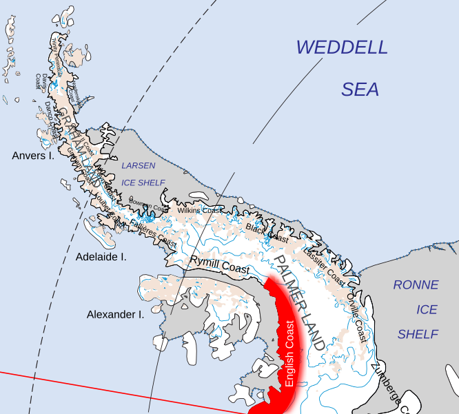
| Description | Location of the English Coast of Palmer Land, in the British Antarctic Territory | ||
| Date | |||
| Source | Map of Queen Elizabeth Land, BAT.svg | ||
| Author | Hogweard | ||
| Permission (Reusing this file) |
|
File history
Click on a date/time to view the file as it appeared at that time.
| Date/Time | Thumbnail | Dimensions | User | Comment | |
|---|---|---|---|---|---|
| current | 19:13, 19 July 2020 | | 1,018 × 917 (4.51 MB) | Hogweard (talk | contribs) | {{Information |description=Location of the English Coast of Palmer Land, in the British Antarctic Territory |date=2020-07-19 |source={{f|Map of Queen Elizabeth Land, BAT.svg}} |author={{u|Hogweard}} |permission={{PD-self}} |other versions= }} Category:Maps of the British Antarctic Territory Category:Locator maps of Antarctic Peninsula |
You cannot overwrite this file.
File usage on Commons
The following page uses this file:
File usage on other wikis
The following other wikis use this file:
- Usage on cs.wikipedia.org
- Usage on de.wikipedia.org
- Usage on en.wikipedia.org
- Usage on it.wikipedia.org
- Usage on pl.wikipedia.org