File:English districts map 2021.svg

Size of this PNG preview of this SVG file: 494 × 600 pixels. Other resolutions: 198 × 240 pixels | 395 × 480 pixels | 633 × 768 pixels | 843 × 1,024 pixels | 1,687 × 2,048 pixels | 1,108 × 1,345 pixels.
Original file (SVG file, nominally 1,108 × 1,345 pixels, file size: 493 KB)
Captions
Captions
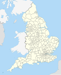
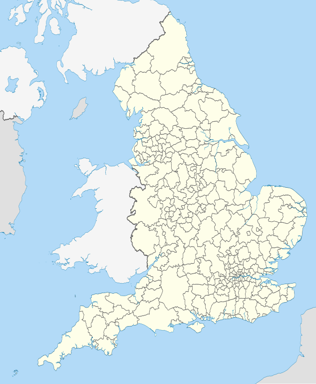
Map of the districts of England in 2021
Summary
edit
| Description |
English: Map showing the all of the districts of England from 1 April 2021 to 31 March 2023.
Equirectangular map projection on WGS 84 datum, with N/S stretched 170% Geographic limits:
Changes since the 2020 version:
|
| Date | |
| Source |
This file was derived from: English districts 2010.svg:  |
| Author | |
| Other versions |
Licensing
edit
This file is licensed under the Creative Commons Attribution-Share Alike 4.0 International license.
Attribution: Nilfanion and Dr Greg. Contains Ordnance Survey data © Crown copyright and database right 2010.
- You are free:
- to share – to copy, distribute and transmit the work
- to remix – to adapt the work
- Under the following conditions:
- attribution – You must give appropriate credit, provide a link to the license, and indicate if changes were made. You may do so in any reasonable manner, but not in any way that suggests the licensor endorses you or your use.
- share alike – If you remix, transform, or build upon the material, you must distribute your contributions under the same or compatible license as the original.
File history
Click on a date/time to view the file as it appeared at that time.
| Date/Time | Thumbnail | Dimensions | User | Comment | |
|---|---|---|---|---|---|
| current | 18:45, 13 May 2022 | | 1,108 × 1,345 (493 KB) | Dr Greg (talk | contribs) | Uploaded a work by * ''English districts 2010.svg'': Nilfanion * derivative work: Dr Greg from {{Derived from |English districts 2010.svg |display=50}} with UploadWizard |
You cannot overwrite this file.
File usage on Commons
There are no pages that use this file.