File:Engorda Marmolejo San Jose.jpeg

Size of this preview: 800 × 450 pixels. Other resolutions: 320 × 180 pixels | 640 × 360 pixels | 1,024 × 576 pixels | 1,280 × 720 pixels | 2,560 × 1,440 pixels | 4,224 × 2,376 pixels.
Original file (4,224 × 2,376 pixels, file size: 2.39 MB, MIME type: image/jpeg)
Captions
Captions
Add a one-line explanation of what this file represents
Summary
edit
| Description |
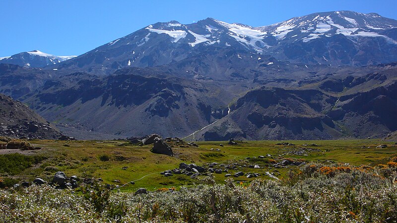
English: Valle de la Engorda (a little over 2,500m[1], 2,600m according to John Biggar, ISBN 0-9536087-2-7, 221), as seen from the point where, having rounded the Morro Negro ridge, you enter it, looking east-north-east.
In the background, from left to right (north to south), Cerro Marmolejo (6,108m), Volcán Espíritu Santo (5,692m), and Volcán San José (5,856m). Also clearly visible are the Quebrada Norte and the Quebrada Sur, coming down from San José. Directly to the west of the Engorda Valley is the Parque Nacional El Morado. The photo was taken just days after the massive 2010 Chile earthquake. |
| Date | |
| Source | Own work |
| Author | Tijs Michels |
| Permission (Reusing this file) |
cc-by-sa-3.0 (attribution required - see below) |
Licensing
edit
I, the copyright holder of this work, hereby publish it under the following license:
This file is licensed under the Creative Commons Attribution-Share Alike 3.0 Unported license.
- You are free:
- to share – to copy, distribute and transmit the work
- to remix – to adapt the work
- Under the following conditions:
- attribution – You must give appropriate credit, provide a link to the license, and indicate if changes were made. You may do so in any reasonable manner, but not in any way that suggests the licensor endorses you or your use.
- share alike – If you remix, transform, or build upon the material, you must distribute your contributions under the same or compatible license as the original.
File history
Click on a date/time to view the file as it appeared at that time.
| Date/Time | Thumbnail | Dimensions | User | Comment | |
|---|---|---|---|---|---|
| current | 21:37, 18 November 2010 | | 4,224 × 2,376 (2.39 MB) | Tmichels (talk | contribs) | {{Information |Description={{en|1=Valle de la Engorda (a little over 2,500m[http://www.andeshandbook.org/waypoints.asp?idruta=42], 2,600m according to John Biggar, ISBN 0-9536087-2-7, 221), as seen from the point where, having rounded the Morro Negro ridg |
You cannot overwrite this file.
File usage on Commons
The following page uses this file: