File:Entraunes Wikipédia 131.jpg
Size of this preview: 335 × 599 pixels. Other resolutions: 134 × 240 pixels | 268 × 480 pixels | 799 × 1,428 pixels.
Original file (799 × 1,428 pixels, file size: 281 KB, MIME type: image/jpeg)
Captions
Captions
Add a one-line explanation of what this file represents
Summary
edit
| Description |
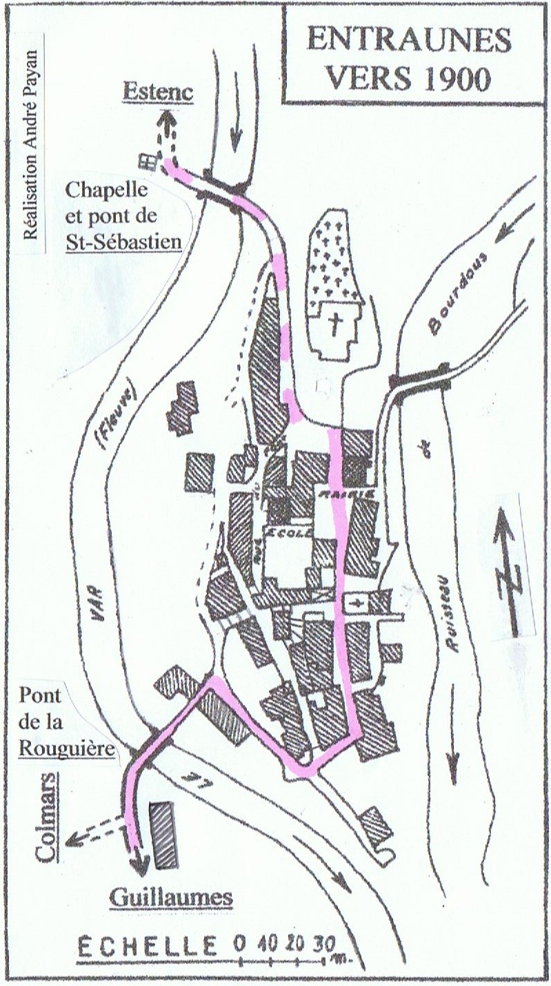
Français : Plan du village d'Entraunes vers 1900 réalisé par André Payan. En mauve est figurée la route carrossable empruntée notamment par la diligence. Route qui, venant de Nice par Guillaumes et Saint-Martin-d'Entraunes, franchit alors le Var par le pont de la Rouguière, passe par le chemin de Pied-de-Ville puis monte par la Grande-Rue pour s'arrêter à la place de la Mairie. Les chemins muletiers sont figurés en tirets mauves. Celui allant à Colmars (04) par le col des Champs, celui allant au col des Trente-Souches par le pont sur le Bourdous et celui allant au col de la Cayolle et Barcelonnette (04) par Estenc |
| Date | |
| Source | Own work |
| Author | PAYAN |
Licensing
edit
I, the copyright holder of this work, hereby publish it under the following licenses:

|
Permission is granted to copy, distribute and/or modify this document under the terms of the GNU Free Documentation License, Version 1.2 or any later version published by the Free Software Foundation; with no Invariant Sections, no Front-Cover Texts, and no Back-Cover Texts. A copy of the license is included in the section entitled GNU Free Documentation License. |
This file is licensed under the Creative Commons Attribution-Share Alike 3.0 Unported, 2.5 Generic, 2.0 Generic and 1.0 Generic license.
- You are free:
- to share – to copy, distribute and transmit the work
- to remix – to adapt the work
- Under the following conditions:
- attribution – You must give appropriate credit, provide a link to the license, and indicate if changes were made. You may do so in any reasonable manner, but not in any way that suggests the licensor endorses you or your use.
- share alike – If you remix, transform, or build upon the material, you must distribute your contributions under the same or compatible license as the original.
You may select the license of your choice.
File history
Click on a date/time to view the file as it appeared at that time.
| Date/Time | Thumbnail | Dimensions | User | Comment | |
|---|---|---|---|---|---|
| current | 09:24, 28 March 2009 | | 799 × 1,428 (281 KB) | PAYAN (talk | contribs) | {{Information |Description={{fr|1=Plan du village d'Entraunes vers 1900 réalisé par André Payan}} |Source=travail personnel (own work) |Author=PAYAN |Date=28 mars 2009 |Permission= |other_versions= }} <!--{{ImageUpload|full}}--> |
You cannot overwrite this file.
File usage on Commons
There are no pages that use this file.
File usage on other wikis
The following other wikis use this file:
- Usage on fr.wikipedia.org