File:ErbachRhgKisselbachFahrdammSHochwasserrückhaltebecken.JPG

Size of this preview: 799 × 599 pixels. Other resolutions: 320 × 240 pixels | 640 × 480 pixels | 1,024 × 768 pixels | 1,280 × 960 pixels | 2,560 × 1,920 pixels | 2,918 × 2,189 pixels.
Original file (2,918 × 2,189 pixels, file size: 2.26 MB, MIME type: image/jpeg)
Captions
Captions
Add a one-line explanation of what this file represents
Summary edit
| Description |
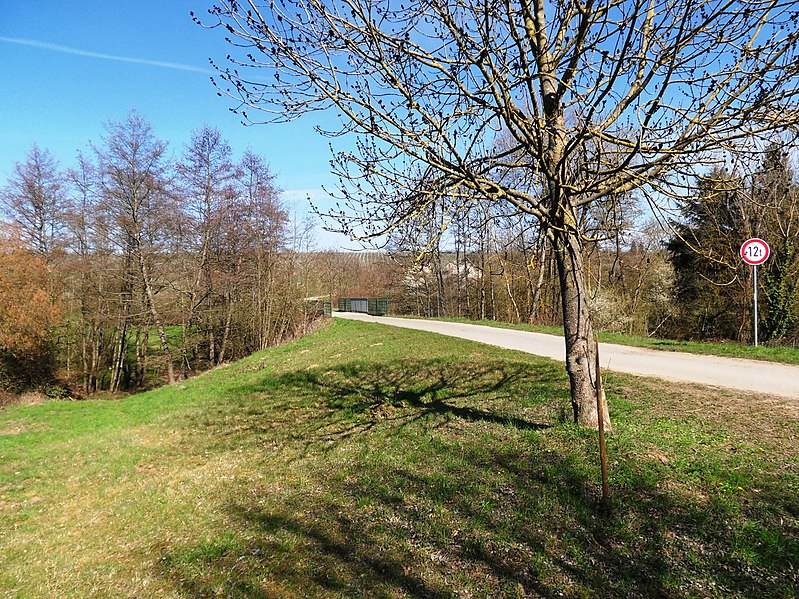
Deutsch: Erbach Rheingau: Fahrweg über den Staudamm des Hochwasserrückhaltebeckens 700 m vor dem Einlauf des Kisselbachs in die Verrohrung für die unterirdische Passage der Ortslage von Erbach. Der Damm ist ca. 100 m lang und das Retentionsbecken reicht ca. 200 m bachaufwärts. Errichtet wurde dieses Hochwasserschutzbauwerk nach der für Erbach tragischen Unwetter-Katastrophe vom 9. Mai 1990. |
| Date | Taken on 29 March 2021 |
| Source | Own work |
| Author | Brühl |
| Camera location | | View this and other nearby images on: OpenStreetMap |
|---|
Licensing edit
I, the copyright holder of this work, hereby publish it under the following license:
This file is licensed under the Creative Commons Attribution-Share Alike 3.0 Germany license.
- You are free:
- to share – to copy, distribute and transmit the work
- to remix – to adapt the work
- Under the following conditions:
- attribution – You must give appropriate credit, provide a link to the license, and indicate if changes were made. You may do so in any reasonable manner, but not in any way that suggests the licensor endorses you or your use.
- share alike – If you remix, transform, or build upon the material, you must distribute your contributions under the same or compatible license as the original.

File history
Click on a date/time to view the file as it appeared at that time.
| Date/Time | Thumbnail | Dimensions | User | Comment | |
|---|---|---|---|---|---|
| current | 14:59, 28 June 2021 | | 2,918 × 2,189 (2.26 MB) | Brühl (talk | contribs) | == {{int:filedesc}} == {{Information |Description={{de|1=Erbach Rheingau: Fahrweg über den Staudamm des Hochwasserrückhaltebeckens 700 m vor dem Einlauf des Kisselbachs in die Verrohrung für die unterirdische Passage der Ortslage von Erbach. Der Damm ist ca. 120 m lang und das Retentionsbecken reicht ca. 200 m bachaufwärts. Errichtet wurde dieses Hochwasserschutzbauwerk nach der für Erbach tragischen Unwetter-Katastrophe vom 9. Mai 1990.}} |Source={{own}} |Author=Brühl |Date={{... |
You cannot overwrite this file.
File usage on Commons
There are no pages that use this file.
File usage on other wikis
The following other wikis use this file:
- Usage on de.wikipedia.org