File:Erdkruste.jpg
Size of this preview: 800 × 485 pixels. Other resolutions: 320 × 194 pixels | 640 × 388 pixels | 952 × 577 pixels.
Original file (952 × 577 pixels, file size: 116 KB, MIME type: image/jpeg)
Captions
Captions
Add a one-line explanation of what this file represents
Summary edit
| Description |
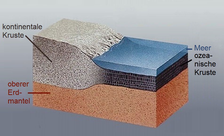
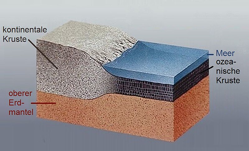
Deutsch: Darstellung kontinentaler und ozeanischer Kruste an einem passiven Kontinentalrand
|
||||||
| Date | |||||||
| Source | USGS - Earthquake Glossary | ||||||
| Author |
USGS
|
||||||
| Permission (Reusing this file) |
|
||||||
| Other versions |
[]
|
||||||


File history
Click on a date/time to view the file as it appeared at that time.
| Date/Time | Thumbnail | Dimensions | User | Comment | |
|---|---|---|---|---|---|
| current | 07:37, 29 October 2019 | | 952 × 577 (116 KB) | Sciencia58 (talk | contribs) | neu |
| 09:22, 26 October 2019 |  | 484 × 289 (47 KB) | Sciencia58 (talk | contribs) | neu | |
| 09:18, 26 October 2019 |  | 469 × 289 (47 KB) | Sciencia58 (talk | contribs) | Beschriftung | |
| 12:40, 11 February 2006 |  | 366 × 281 (33 KB) | Maksim (talk | contribs) | La bildo estas kopiita de wikipedia:de. La originala priskribo estas: * Bildbeschreibung: Darstellung kontinentaler und ozeanischer Kruste an einem passiven Kontinentalrand. * Quelle: [http://earthquake.usgs.gov/image_glossary/crust.html USGS: Crust] * F |
You cannot overwrite this file.
File usage on Commons
The following page uses this file:
File usage on other wikis
The following other wikis use this file:
- Usage on bs.wikipedia.org
- Usage on li.wikipedia.org
- Usage on nds.wikipedia.org