File:EskiImaretMosque2007.jpg

Size of this preview: 408 × 599 pixels. Other resolutions: 163 × 240 pixels | 545 × 800 pixels.
Original file (545 × 800 pixels, file size: 293 KB, MIME type: image/jpeg)
Captions
Captions
Add a one-line explanation of what this file represents
Summary
edit
| Description | |
| Date | |
| Source | Own work |
| Author | Muscol |
| Camera location | | View this and other nearby images on: OpenStreetMap |
|---|
Licensing
edit
I, the copyright holder of this work, hereby publish it under the following licenses:
This file is licensed under the Creative Commons Attribution-Share Alike 3.0 Unported license.
- You are free:
- to share – to copy, distribute and transmit the work
- to remix – to adapt the work
- Under the following conditions:
- attribution – You must give appropriate credit, provide a link to the license, and indicate if changes were made. You may do so in any reasonable manner, but not in any way that suggests the licensor endorses you or your use.
- share alike – If you remix, transform, or build upon the material, you must distribute your contributions under the same or compatible license as the original.

|
Permission is granted to copy, distribute and/or modify this document under the terms of the GNU Free Documentation License, Version 1.2 or any later version published by the Free Software Foundation; with no Invariant Sections, no Front-Cover Texts, and no Back-Cover Texts. A copy of the license is included in the section entitled GNU Free Documentation License. |
You may select the license of your choice.
| Annotations | This image is annotated: View the annotations at Commons |
File history
Click on a date/time to view the file as it appeared at that time.
| Date/Time | Thumbnail | Dimensions | User | Comment | |
|---|---|---|---|---|---|
| current | 14:17, 27 December 2011 | | 545 × 800 (293 KB) | Ggia (talk | contribs) | white balance |
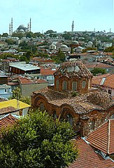
| 14:43, 11 July 2008 |  | 545 × 800 (288 KB) | Muscol (talk | contribs) | {{Information |Description={{en|1=an aerial view showing the location of eski imaret mosque}} |Source=Own work by uploader |Author=Muscol |Date=june 23, 2007 |Permission= |other_versions= }} {{ImageUpload|full}} |
You cannot overwrite this file.
File usage on Commons
There are no pages that use this file.
File usage on other wikis
The following other wikis use this file:
- Usage on arz.wikipedia.org
- Usage on ba.wikipedia.org
- Usage on el.wikipedia.org
- Usage on en.wikipedia.org
- Usage on es.wikipedia.org
- Usage on fr.wikipedia.org
- Usage on hy.wikipedia.org
- Usage on it.wikipedia.org
- Usage on mk.wikipedia.org
- Usage on mrj.wikipedia.org
- Usage on pnb.wikipedia.org
- Usage on ru.wikipedia.org
- Usage on rw.wikipedia.org
- Usage on tr.wikipedia.org
- Usage on uk.wikipedia.org
- Usage on ur.wikipedia.org
- Usage on uz.wikipedia.org
- Usage on www.wikidata.org
- Usage on zh.wikipedia.org