File:Estate Bethlehem on a map of 1779 by the military surveyor F. C. von Meley.jpg

Size of this preview: 800 × 546 pixels. Other resolutions: 320 × 218 pixels | 640 × 437 pixels | 850 × 580 pixels.
Original file (850 × 580 pixels, file size: 242 KB, MIME type: image/jpeg)
Captions
Captions
Add a one-line explanation of what this file represents
Summary
edit
| Description |
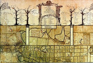
Deutsch: Estate Bethlehem on a map of 1779 by the military surveyor F. C. von Meley |
| Date | |
| Source | https://www.researchgate.net/figure/Meley-1779-Estate-Bethlehem-map-North-is-to-the-right-Lower-Bethlehem-is-on-the-far_fig8_33762938 |
| Author | F. C. von Meley, military surveyor, 1779 |
Licensing
edit
|
This is a faithful photographic reproduction of a two-dimensional, public domain work of art. The work of art itself is in the public domain for the following reason:
The official position taken by the Wikimedia Foundation is that "faithful reproductions of two-dimensional public domain works of art are public domain".
This photographic reproduction is therefore also considered to be in the public domain in the United States. In other jurisdictions, re-use of this content may be restricted; see Reuse of PD-Art photographs for details. | ||||
File history
Click on a date/time to view the file as it appeared at that time.
| Date/Time | Thumbnail | Dimensions | User | Comment | |
|---|---|---|---|---|---|
| current | 09:51, 28 March 2019 | | 850 × 580 (242 KB) | NearEMPTiness (talk | contribs) | User created page with UploadWizard |
You cannot overwrite this file.
File usage on Commons
There are no pages that use this file.
File usage on other wikis
The following other wikis use this file:
- Usage on en.wikipedia.org