File:Ethiopia administrative boundaries.svg

Size of this PNG preview of this SVG file: 785 × 600 pixels. Other resolutions: 314 × 240 pixels | 629 × 480 pixels | 1,006 × 768 pixels | 1,280 × 978 pixels | 2,560 × 1,955 pixels.
Original file (SVG file, nominally 800 × 611 pixels, file size: 11.29 MB)
Captions
Captions
Hadale'ela Afar Ethiopia
Hadale'ela Afar Ethiopia
Summary
edit
| Description |
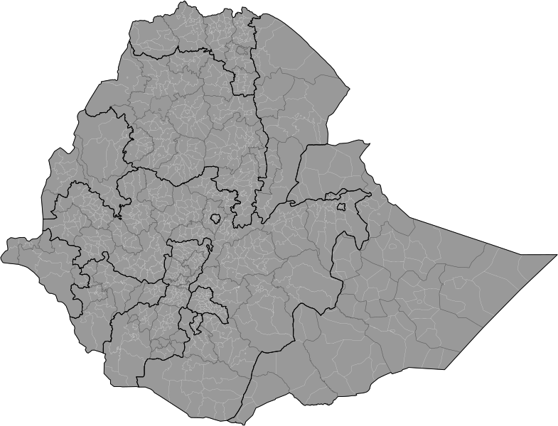
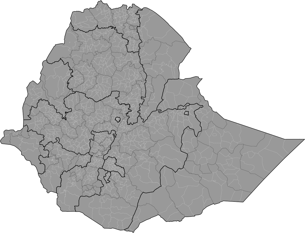
English: Ethiopian administrative boundaries from regions to woredas (districts) as of December 2021. Note the Eritrean-Ethiopian border is the de facto border and not de-jure.
Region border
Zone border
Woreda border |
| Date | |
| Source | Own work based on OCHA map |
| Author | Ue3lman |
Licensing
edit
I, the copyright holder of this work, hereby publish it under the following license:
This file is licensed under the Creative Commons Attribution-Share Alike 4.0 International license.
- You are free:
- to share – to copy, distribute and transmit the work
- to remix – to adapt the work
- Under the following conditions:
- attribution – You must give appropriate credit, provide a link to the license, and indicate if changes were made. You may do so in any reasonable manner, but not in any way that suggests the licensor endorses you or your use.
- share alike – If you remix, transform, or build upon the material, you must distribute your contributions under the same or compatible license as the original.
File history
Click on a date/time to view the file as it appeared at that time.
| Date/Time | Thumbnail | Dimensions | User | Comment | |
|---|---|---|---|---|---|
| current | 22:17, 25 December 2021 | | 800 × 611 (11.29 MB) | Ue3lman (talk | contribs) | Uploaded own work with UploadWizard |
You cannot overwrite this file.
File usage on Commons
The following page uses this file:
File usage on other wikis
The following other wikis use this file:
- Usage on am.wikipedia.org
- Usage on bg.wikipedia.org
- Usage on ca.wikipedia.org
- Usage on de.wikipedia.org
- Usage on en.wikipedia.org
- Usage on es.wikipedia.org
- Usage on fr.wikipedia.org
- Usage on nn.wikipedia.org
- Usage on no.wikipedia.org
- Usage on pt.wikipedia.org
- Usage on ru.wikipedia.org
- Usage on sv.wikipedia.org
- Usage on uk.wikipedia.org
- Usage on vi.wikipedia.org
- Usage on zu.wikipedia.org