File:Europe-map-1900 mapa-de-europa-1910.jpg
Size of this preview: 800 × 449 pixels. Other resolutions: 320 × 180 pixels | 640 × 359 pixels | 1,024 × 574 pixels | 1,280 × 718 pixels | 1,911 × 1,072 pixels.
Original file (1,911 × 1,072 pixels, file size: 891 KB, MIME type: image/jpeg)
Captions
Captions
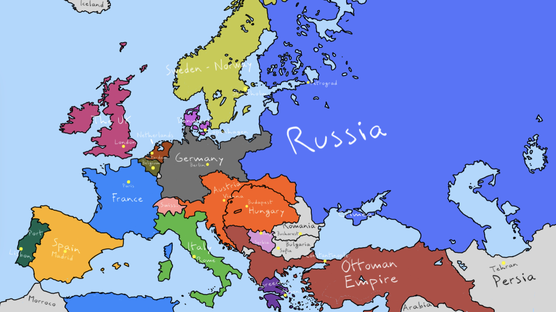
A map explaining the borders of the most disastrous continent in history at the beginning of the 20th century.

Summary edit
| Description |
English: This file represents the map of Europe in 1910
Español: este archivo representa el mapa de europa en 1910
Français : ce fichier représente la carte de l'europe en 1910 |
| Date | |
| Source | Own work |
| Author | Tise exists (cool) |
Licensing edit
I, the copyright holder of this work, hereby publish it under the following license:
This file is licensed under the Creative Commons Attribution-Share Alike 4.0 International license.
- You are free:
- to share – to copy, distribute and transmit the work
- to remix – to adapt the work
- Under the following conditions:
- attribution – You must give appropriate credit, provide a link to the license, and indicate if changes were made. You may do so in any reasonable manner, but not in any way that suggests the licensor endorses you or your use.
- share alike – If you remix, transform, or build upon the material, you must distribute your contributions under the same or compatible license as the original.
File history
Click on a date/time to view the file as it appeared at that time.
| Date/Time | Thumbnail | Dimensions | User | Comment | |
|---|---|---|---|---|---|
| current | 21:29, 26 March 2022 | | 1,911 × 1,072 (891 KB) | Tise exists (cool) (talk | contribs) | Uploaded own work with UploadWizard |
You cannot overwrite this file.
File usage on Commons
There are no pages that use this file.