File:Europe regions (uk).png
Size of this preview: 688 × 600 pixels. Other resolutions: 275 × 240 pixels | 551 × 480 pixels | 881 × 768 pixels | 1,175 × 1,024 pixels | 2,000 × 1,743 pixels.
Original file (2,000 × 1,743 pixels, file size: 803 KB, MIME type: image/png)
Captions
Captions
Add a one-line explanation of what this file represents
Summary edit
| Description |
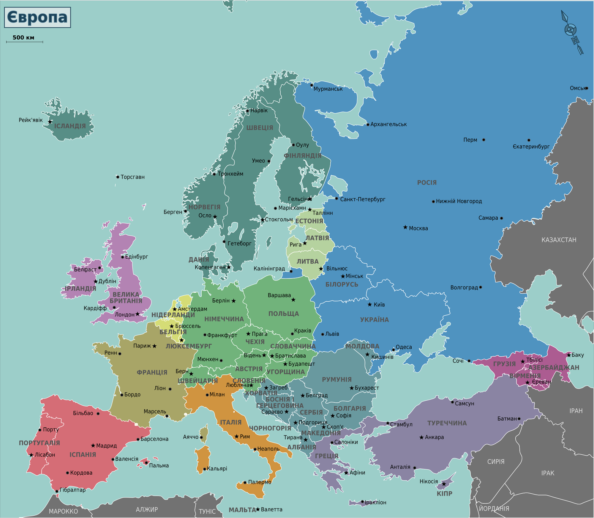
English: Map of Europe for use on Wikivoyage, Ukrainian version
Українська: Карта Європи для використання у Вікімандрах, українська версія |
| Date | |
| Source | Own work based on the blank map of Europe by Historicair |
| Author | Stefan Ertmann, Ukrainian translation by Vladimirs Metencuks |
| Other versions |
[]
Notes:
|
.svg)

.png)
.png)
.png)
.png)
.png)
.png)
.png)
.png)
.png)
-%E6%AC%A7%E6%B4%B2%E5%85%A8%E5%9B%BE.png)

.svg)


.png)


.png&action=edit§ion=1)
Licensing edit
.png&action=edit§ion=2)
This file is licensed under the Creative Commons Attribution-Share Alike 4.0 International, 3.0 Unported, 2.5 Generic, 2.0 Generic and 1.0 Generic license.
- You are free:
- to share – to copy, distribute and transmit the work
- to remix – to adapt the work
- Under the following conditions:
- attribution – You must give appropriate credit, provide a link to the license, and indicate if changes were made. You may do so in any reasonable manner, but not in any way that suggests the licensor endorses you or your use.
- share alike – If you remix, transform, or build upon the material, you must distribute your contributions under the same or compatible license as the original.
File history
Click on a date/time to view the file as it appeared at that time.
| Date/Time | Thumbnail | Dimensions | User | Comment | |
|---|---|---|---|---|---|
| current | 21:39, 1 February 2013 | | 2,000 × 1,743 (803 KB) | Voll (talk | contribs) | User created page with UploadWizard |
You cannot overwrite this file.
File usage on Commons
The following 21 pages use this file:
- File:Europe regions(ja).png
- File:Europe regions(pt).png
- File:Europe regions(sv).png
- File:Europe regions.png
- File:Europe regions.svg
- File:Europe regions (cs).svg
- File:Europe regions (fi).png
- File:Europe regions (fr).png
- File:Europe regions (nl).png
- File:Europe regions (ru).png
- File:Europe regions (sr).png
- File:Europe regions (uk).png
- File:Europe regions (zh-hans)-欧洲全图.png
- File:Europe regions AR.svg
- File:Europe regions minimal cities.png
- File:Europe regions minimal cities.svg
- File:Europe regions minimal cities (az).svg
- File:Europe regions minimal cities (it).png
- File:Europe regions minimal cities hi.svg
- File:خريطة اوروبا السياسية.png
- Template:Other versions/Europe regions
File usage on other wikis
The following other wikis use this file:
- Usage on uk.wikivoyage.org
.png&oldid=659276454)