File:Evacuation-cost-map-based-on-land-use-and-slope.jpg
Size of this preview: 713 × 599 pixels. Other resolutions: 286 × 240 pixels | 571 × 480 pixels | 914 × 768 pixels | 1,260 × 1,059 pixels.
Original file (1,260 × 1,059 pixels, file size: 1.66 MB, MIME type: image/jpeg)
Captions
Captions
Add a one-line explanation of what this file represents
Summary
edit
| Description |
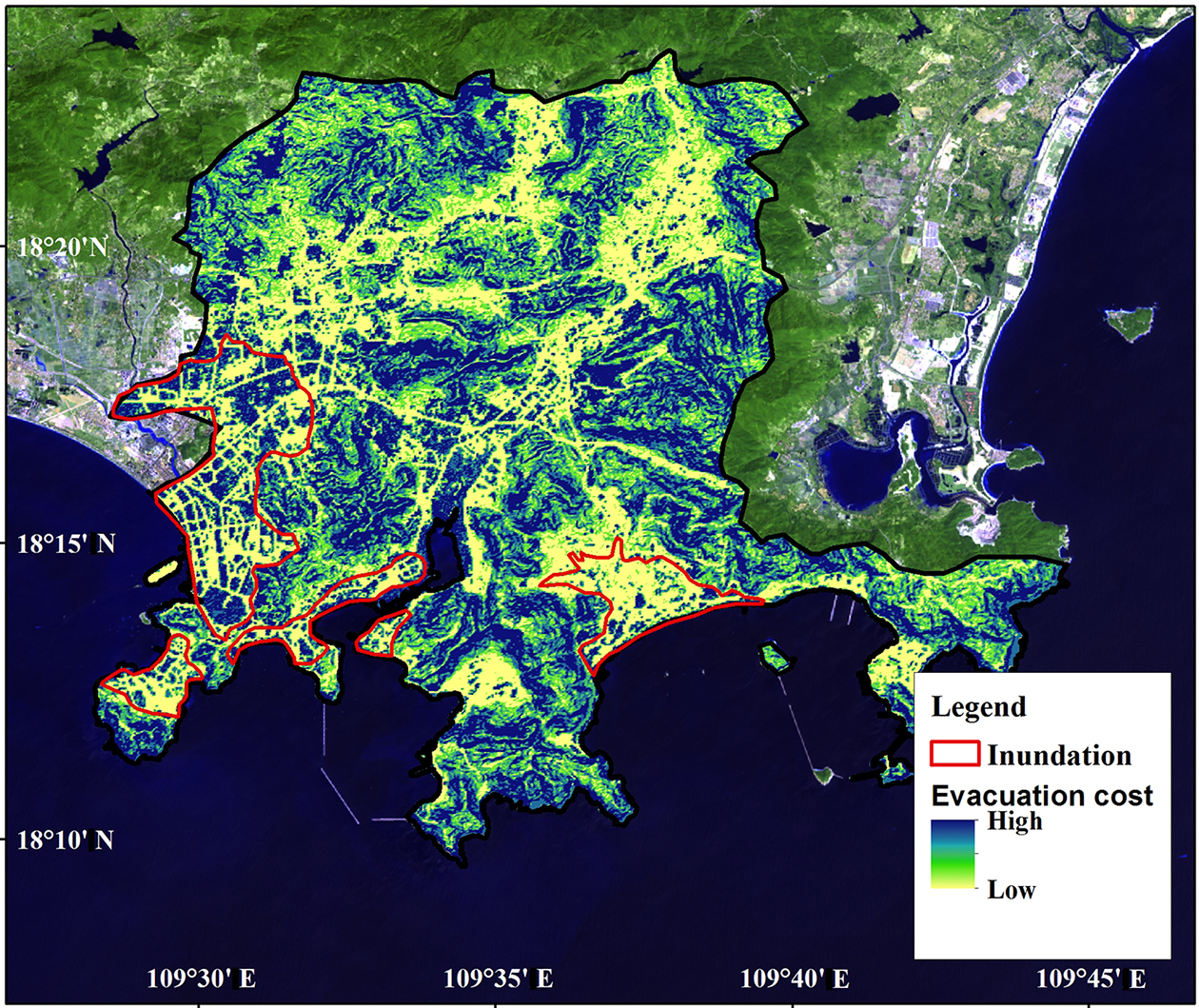
English: Evacuation cost map based on land use and slope. |
| Date | |
| Source | Jingming Hou et. al. "Development of a decision support system for tsunami evacuation: application to the Jiyang District of Sanya city in China", Natural Hazards and Earth System Sciences doi:10.5194/nhess-17-335-2017 |
| Author | Jingming Hou, Ye Yuan, Peitao Wang, Zhiyuan Ren, Xiaojuan Li |
| Permission (Reusing this file) |
This work is licensed under a Creative Commons Attribution 3.0 Unported License. To view a copy of this license, visit https://creativecommons.org/licenses/by/3.0/ |
==Licensing==
This file is licensed under the Creative Commons Attribution 3.0 Unported license.
- You are free:
- to share – to copy, distribute and transmit the work
- to remix – to adapt the work
- Under the following conditions:
- attribution – You must give appropriate credit, provide a link to the license, and indicate if changes were made. You may do so in any reasonable manner, but not in any way that suggests the licensor endorses you or your use.
File history
Click on a date/time to view the file as it appeared at that time.
| Date/Time | Thumbnail | Dimensions | User | Comment | |
|---|---|---|---|---|---|
| current | 12:59, 12 March 2020 | | 1,260 × 1,059 (1.66 MB) | Sohmen (talk | contribs) | Uploaded by the NOA Upload Tool |
You cannot overwrite this file.
File usage on Commons
There are no pages that use this file.