File:Expressway map around Kyoto City 2021.png
Size of this preview: 600 × 600 pixels. Other resolutions: 240 × 240 pixels | 480 × 480 pixels | 768 × 768 pixels | 1,024 × 1,024 pixels | 1,600 × 1,600 pixels.
Original file (1,600 × 1,600 pixels, file size: 93 KB, MIME type: image/png)
Captions
Captions
Add a one-line explanation of what this file represents
Summary edit
| Description |
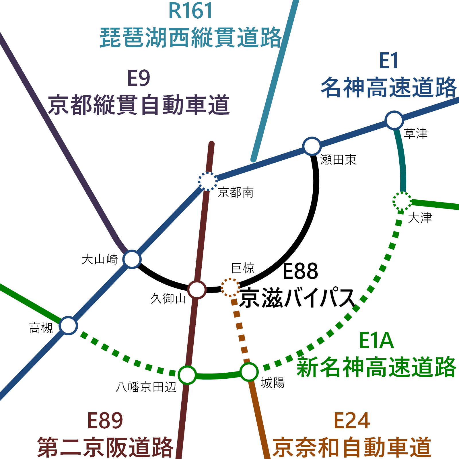
日本語: 京都市周辺の主要な自動車専用道路の地図。点線部分は建設中または調査中。 |
| Date | |
| Source | Own work |
| Author | Narenko |
| Other versions | Derivative works of this file: Expressway map around Kyoto City, 2021.png |
Licensing edit
I, the copyright holder of this work, hereby publish it under the following license:
| This file is made available under the Creative Commons CC0 1.0 Universal Public Domain Dedication. | |
| The person who associated a work with this deed has dedicated the work to the public domain by waiving all of their rights to the work worldwide under copyright law, including all related and neighboring rights, to the extent allowed by law. You can copy, modify, distribute and perform the work, even for commercial purposes, all without asking permission.
|
File history
Click on a date/time to view the file as it appeared at that time.
| Date/Time | Thumbnail | Dimensions | User | Comment | |
|---|---|---|---|---|---|
| current | 11:56, 22 March 2022 | | 1,600 × 1,600 (93 KB) | Narenko (talk | contribs) | Change of color |
| 16:47, 18 March 2022 |  | 1,600 × 1,600 (93 KB) | Narenko (talk | contribs) | Change of color | |
| 14:01, 12 March 2022 |  | 1,600 × 1,600 (64 KB) | Narenko (talk | contribs) | Change of position | |
| 04:15, 12 March 2022 |  | 1,800 × 1,500 (90 KB) | Narenko (talk | contribs) | Uploaded own work with UploadWizard |
You cannot overwrite this file.
File usage on Commons
The following 4 pages use this file: