File:FGC 254.01 Pla dels Abadals (Santpedor) (14334516220).jpg

Size of this preview: 800 × 533 pixels. Other resolutions: 320 × 213 pixels | 640 × 426 pixels | 1,024 × 682 pixels | 1,280 × 853 pixels | 2,560 × 1,705 pixels | 5,202 × 3,465 pixels.
Original file (5,202 × 3,465 pixels, file size: 7.3 MB, MIME type: image/jpeg)
Captions
Captions
Add a one-line explanation of what this file represents
Summary edit
_(14334516220).jpg&action=edit§ion=1)
| Description |
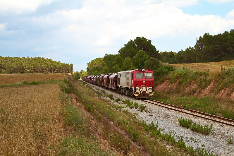
[CAT]: Va arribar el tren i el sol va marxar pel Pla de les Abelles amunt, mentre que la 254.01 agafa aire després de l'esforç realitzat tot just sortir de Sallent. [ES]: Llegó el tren y se fué el sol por el "Pla de les Abelles" hacia arriba, mientras que la 254.01 coge aire después del esfuerzo realizado desde que salió de Sallent. |
| Date | |
| Source | FGC 254.01 Pla dels Abadals (Santpedor) |
| Author | eldelinux from Cataluña, España |
| Camera location | | View this and other nearby images on: OpenStreetMap |
|---|
_(14334516220).jpg¶ms=041.790992_N_0001.875143_E_globe:Earth_type:camera_source:Flickr_&language=en)
Licensing edit
_(14334516220).jpg&action=edit§ion=2)
This file is licensed under the Creative Commons Attribution 2.0 Generic license.
- You are free:
- to share – to copy, distribute and transmit the work
- to remix – to adapt the work
- Under the following conditions:
- attribution – You must give appropriate credit, provide a link to the license, and indicate if changes were made. You may do so in any reasonable manner, but not in any way that suggests the licensor endorses you or your use.
| This image was originally posted to Flickr by eldelinux at https://flickr.com/photos/28528041@N05/14334516220 (archive). It was reviewed on 18 May 2018 by FlickreviewR 2 and was confirmed to be licensed under the terms of the cc-by-2.0. |
File history
Click on a date/time to view the file as it appeared at that time.
| Date/Time | Thumbnail | Dimensions | User | Comment | |
|---|---|---|---|---|---|
| current | 12:40, 18 May 2018 | | 5,202 × 3,465 (7.3 MB) | OceanAtoll (talk | contribs) | Transferred from Flickr via #flickr2commons |
You cannot overwrite this file.
File usage on Commons
There are no pages that use this file.
_(14334516220).jpg&oldid=535840075)