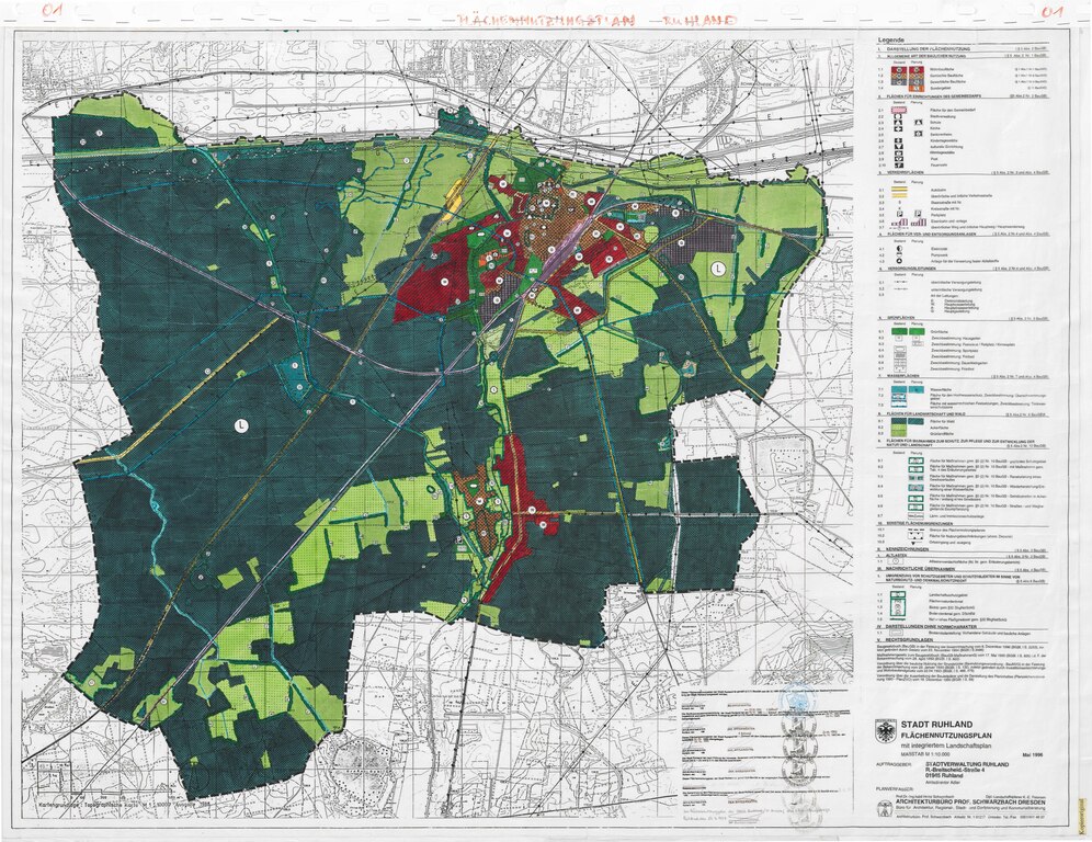
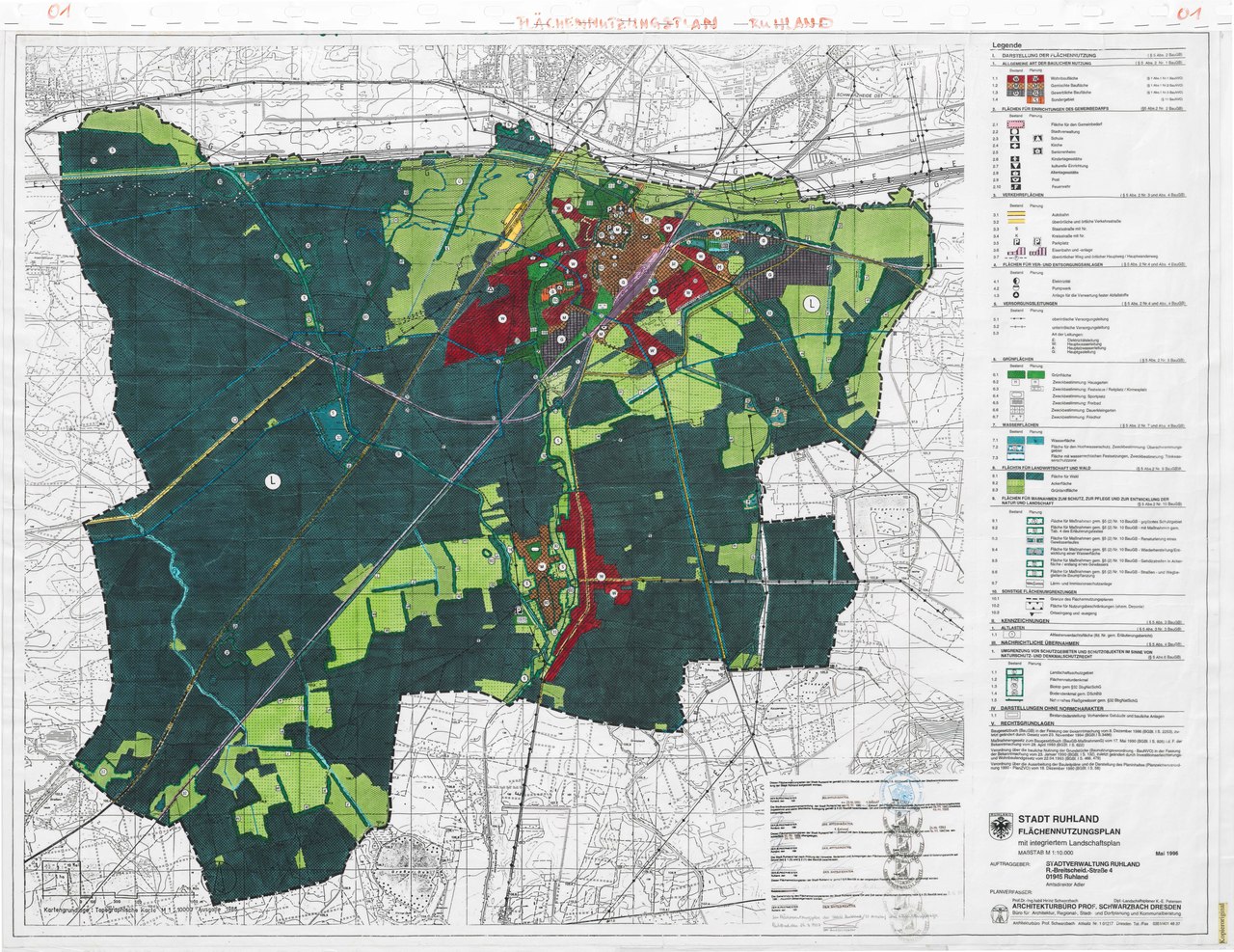
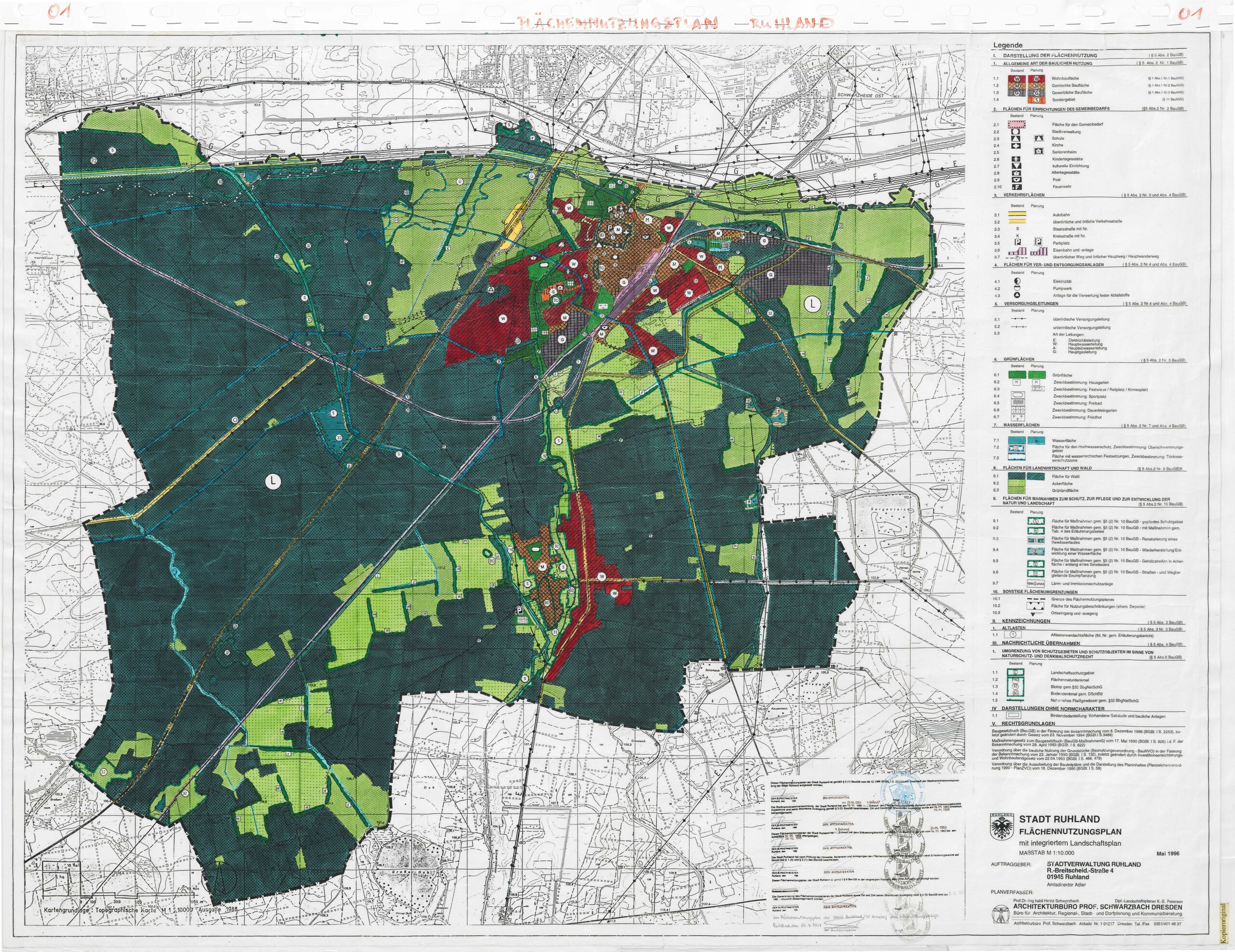
File:FNP Ruhland 1997.pdf

Size of this JPG preview of this PDF file: 777 × 599 pixels. Other resolutions: 311 × 240 pixels | 623 × 480 pixels | 996 × 768 pixels | 1,280 × 987 pixels | 2,560 × 1,974 pixels | 6,539 × 5,043 pixels.
Original file (6,539 × 5,043 pixels, file size: 3.38 MB, MIME type: application/pdf)
Captions
Captions
Add a one-line explanation of what this file represents
Summary edit
| Description |
Deutsch: Flächennutzungsplan Ruhland 1997 |
| Date | |
| Source | https://geoportal.osl-online.de/gdi/pdf_Plaene/FNP/FNP_Hohenbocka.pdf |
| Author |
FNP: Heinz Schwarzbach Architekturbüro Prof.Schwarzbach Dresden Landschaftsplan: K.-E. Petersen Architekturbüro Prof.Schwarzbach Dresden |
| Camera location | | View this and other nearby images on: OpenStreetMap |
|---|
Licensing edit
| This image is in the public domain according to German copyright law because it is part of a statute, ordinance, official decree or judgment (official work) issued by a German authority or court (§ 5 Abs.1 UrhG).
|
 |
File history
Click on a date/time to view the file as it appeared at that time.
| Date/Time | Thumbnail | Dimensions | User | Comment | |
|---|---|---|---|---|---|
| current | 20:49, 26 November 2022 |  | 6,539 × 5,043 (3.38 MB) | Wilhelm Zimmerling PAR (talk | contribs) | Uploaded a work by FNP: Heinz Schwarzbach Architekturbüro Prof.Schwarzbach Dresden Landschaftsplan: K.-E. Petersen Architekturbüro Prof.Schwarzbach Dresden from https://geoportal.osl-online.de/gdi/pdf_Plaene/FNP/FNP_Hohenbocka.pdf with UploadWizard |
You cannot overwrite this file.
File usage on Commons
The following page uses this file: