File:Fabero.svg

Size of this PNG preview of this SVG file: 512 × 385 pixels. Other resolutions: 319 × 240 pixels | 639 × 480 pixels | 1,022 × 768 pixels | 1,280 × 963 pixels | 2,560 × 1,925 pixels.
Original file (SVG file, nominally 512 × 385 pixels, file size: 329 KB)
Captions
Captions
Add a one-line explanation of what this file represents
Summary edit
| Description |
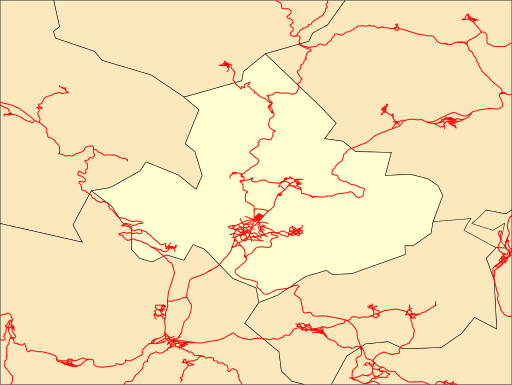
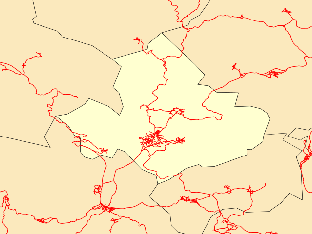
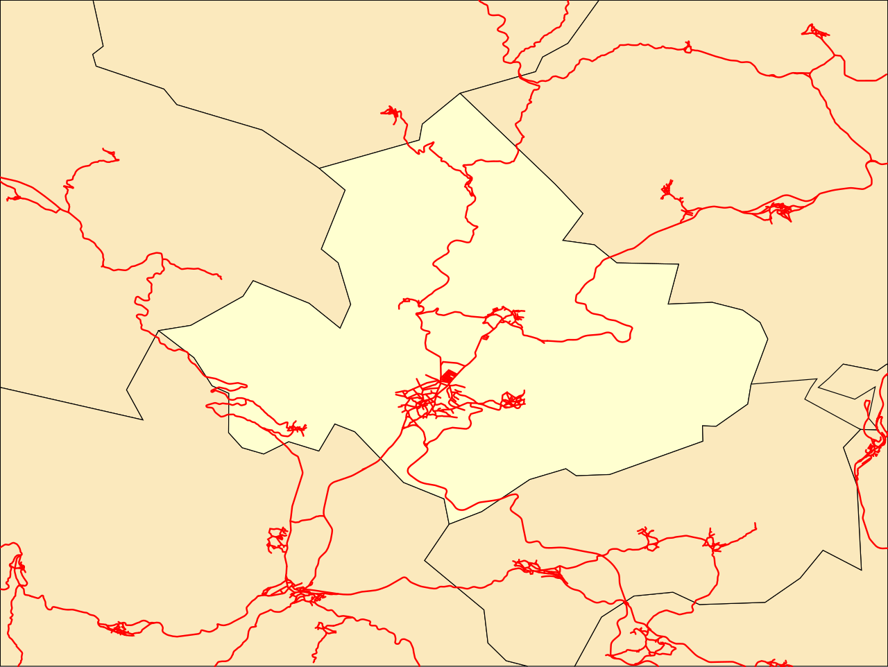
Español: Mapa de localización del municipio de Fabero (Provincia de León-España). Proyección cilíndrica equidistante estirada un 130%. |
|
| Date | ||
| Source | Own work | |
| Author | Rodelar | |
| SVG development | This locator map was created with Inkscape.
|
Licensing edit
This file is licensed under the Creative Commons Attribution-Share Alike 3.0 Unported license.
- You are free:
- to share – to copy, distribute and transmit the work
- to remix – to adapt the work
- Under the following conditions:
- attribution – You must give appropriate credit, provide a link to the license, and indicate if changes were made. You may do so in any reasonable manner, but not in any way that suggests the licensor endorses you or your use.
- share alike – If you remix, transform, or build upon the material, you must distribute your contributions under the same or compatible license as the original.
File history
Click on a date/time to view the file as it appeared at that time.
| Date/Time | Thumbnail | Dimensions | User | Comment | |
|---|---|---|---|---|---|
| current | 00:09, 1 December 2012 | | 512 × 385 (329 KB) | Rodelar (talk | contribs) | User created page with UploadWizard |
You cannot overwrite this file.
File usage on Commons
There are no pages that use this file.
File usage on other wikis
The following other wikis use this file:
- Usage on es.wikipedia.org