File:Fall Creek (Revisited) (2) (11659382605).jpg

Size of this preview: 800 × 533 pixels. Other resolutions: 320 × 213 pixels | 640 × 427 pixels | 1,024 × 683 pixels | 1,280 × 853 pixels | 2,560 × 1,707 pixels | 5,184 × 3,456 pixels.
Original file (5,184 × 3,456 pixels, file size: 13.92 MB, MIME type: image/jpeg)
Captions
Captions
Add a one-line explanation of what this file represents
Summary edit
_(2)_(11659382605).jpg&action=edit§ion=1)
| Description |
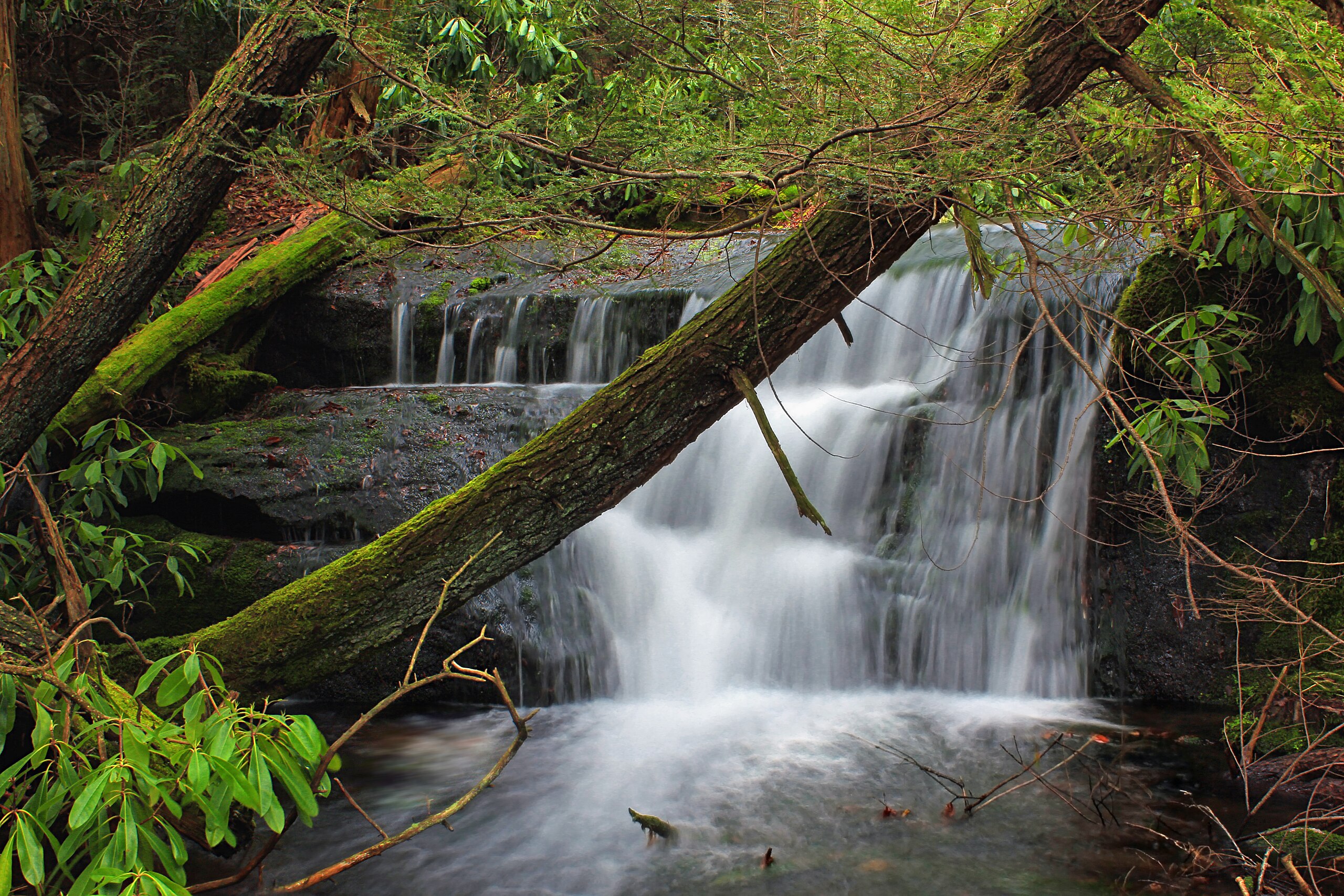
One of several waterfalls on Fall Creek, Monroe County, within State Game Land 38. From its spring-fed headwaters in Fall Gap, the stream descends the Pocono Plateau in a deep, rocky, heavily forested ravine. Along its length are numerous cascades, slides, and waterfalls. The hike largely involves bushwhacking; however, an unblazed footpath occasionally appears on the east side of the stream. |
| Date | |
| Source | Fall Creek (Revisited) (2) |
| Author | Nicholas A. Tonelli from Northeast Pennsylvania, USA |
| Camera location | | View this and other nearby images on: OpenStreetMap |
|---|
_(2)_(11659382605).jpg¶ms=041.035211_N_-075.401186_E_globe:Earth_type:camera_source:Flickr_&language=en)
Licensing edit
_(2)_(11659382605).jpg&action=edit§ion=2)
This file is licensed under the Creative Commons Attribution 2.0 Generic license.
- You are free:
- to share – to copy, distribute and transmit the work
- to remix – to adapt the work
- Under the following conditions:
- attribution – You must give appropriate credit, provide a link to the license, and indicate if changes were made. You may do so in any reasonable manner, but not in any way that suggests the licensor endorses you or your use.
| This image was originally posted to Flickr by Nicholas_T at https://flickr.com/photos/14922165@N00/11659382605. It was reviewed on 10 August 2017 by FlickreviewR and was confirmed to be licensed under the terms of the cc-by-2.0. |
File history
Click on a date/time to view the file as it appeared at that time.
| Date/Time | Thumbnail | Dimensions | User | Comment | |
|---|---|---|---|---|---|
| current | 21:40, 10 August 2017 | | 5,184 × 3,456 (13.92 MB) | XXN (talk | contribs) | Transferred from Flickr via Flickr2Commons |
You cannot overwrite this file.
File usage on Commons
There are no pages that use this file.
_(2)_(11659382605).jpg&oldid=480800283)