File:False gray scale temperature deriving heights of cloud tops (2268-428).jpg

Size of this preview: 800 × 521 pixels. Other resolutions: 320 × 209 pixels | 640 × 417 pixels | 1,024 × 667 pixels | 1,280 × 834 pixels | 2,500 × 1,629 pixels.
Original file (2,500 × 1,629 pixels, file size: 554 KB, MIME type: image/jpeg)
Captions
Captions
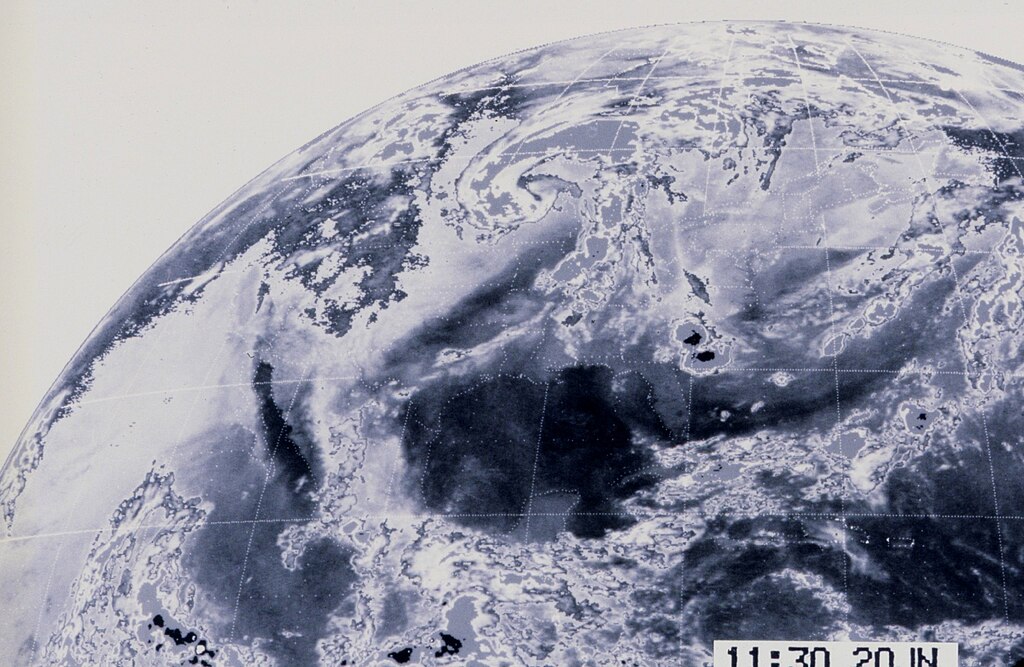
False gray scale temperature deriving heights of cloud tops. The black areasoff Georgia are probably large thunderstorm complexes. A large comma shapedstorm with associated frontal system covers much of the mid-section of the USA.
Summary
edit.jpg&action=edit§ion=1)
| Description |
English: False gray scale temperature deriving heights of cloud tops. The black areasoff Georgia are probably large thunderstorm complexes. A large comma shapedstorm with associated frontal system covers much of the mid-section of the USA.Probably a then experimental project. |
| Source | False gray scale temperature deriving heights of cloud tops. The black areasoff Georgia are probably large thunderstorm complexes. A large comma shapedstorm with associated frontal system covers much of the mid-section of the USA.Probably a then experimental project. |
| Author | NOAA |
| Keywords | Space; Imagery Visible |
Licensing
edit.jpg&action=edit§ion=2)
This image is in the public domain because it contains materials that originally came from the U.S. National Oceanic and Atmospheric Administration, taken or made as part of an employee's official duties.
|
File history
Click on a date/time to view the file as it appeared at that time.
| Date/Time | Thumbnail | Dimensions | User | Comment | |
|---|---|---|---|---|---|
| current | 21:48, 12 June 2024 | | 2,500 × 1,629 (554 KB) | OptimusPrimeBot (talk | contribs) | #Spacemedia - Upload of https://www.noaa.gov/media/ngdl/download-photo/1820231a-1ae8-4cfe-858e-87f6e6595009 via Commons:Spacemedia |
You cannot overwrite this file.
File usage on Commons
The following page uses this file:
.jpg&redirect=no)
.jpg&oldid=883511840)