File:AMS - Series P502 - North Africa - NG-35-07 Bir Abu Minqar.jpg
(Redirected from File:Farafra-txu-oclc-6949452-ng-35-7.jpg)

Size of this preview: 790 × 599 pixels. Other resolutions: 316 × 240 pixels | 633 × 480 pixels | 1,012 × 768 pixels | 1,280 × 971 pixels | 2,560 × 1,943 pixels | 5,000 × 3,794 pixels.
Original file (5,000 × 3,794 pixels, file size: 2.91 MB, MIME type: image/jpeg)
Captions
Captions
Add a one-line explanation of what this file represents
Summary
edit
| Description |
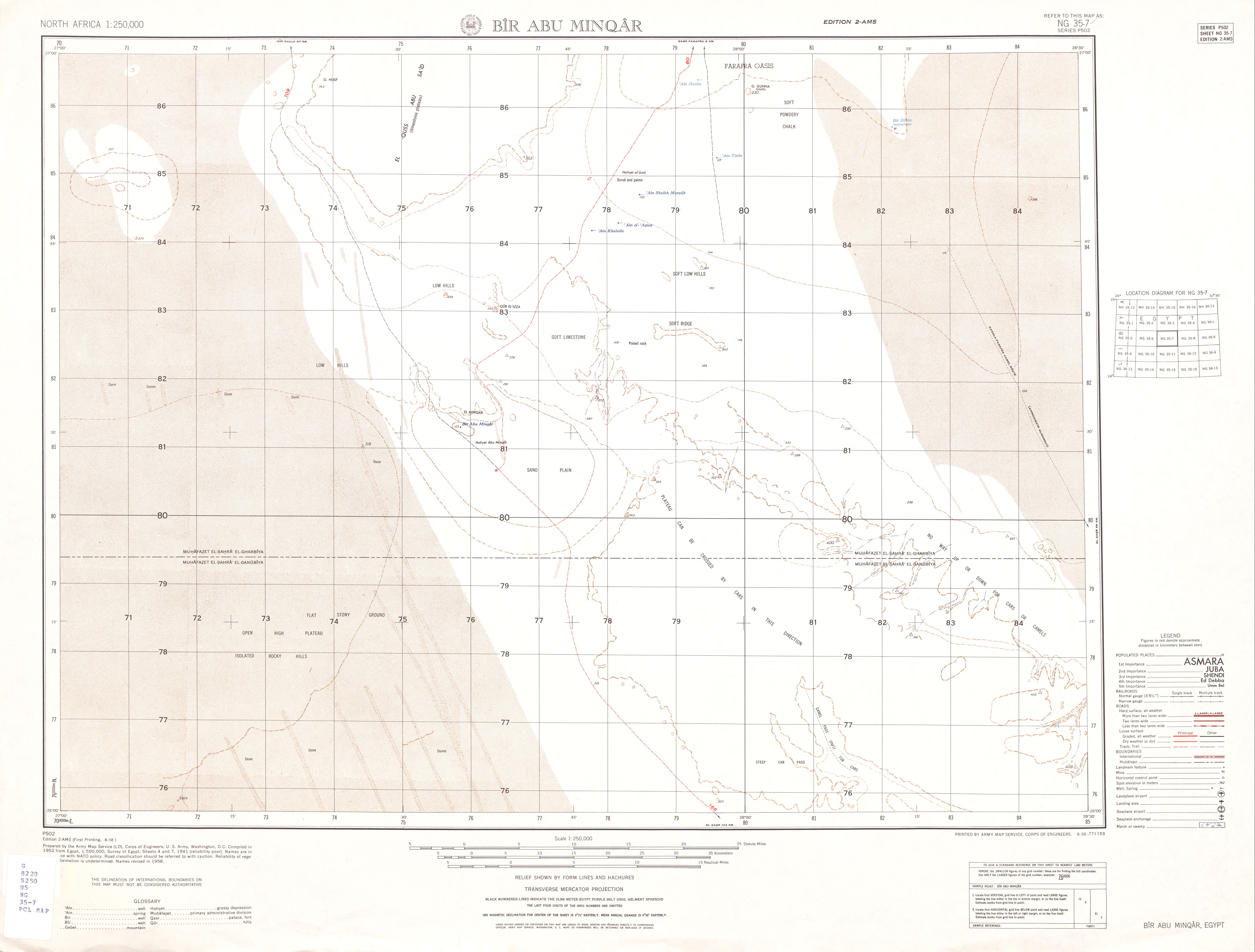
Deutsch: Kartenblatt, das den Südteil Senke el-Farafra, Ägypten, zeigt. 1:250.000
English: Map sheet showing south part of el-Farafra Depression, Egypt. 1:250,000 |
| Date | |
| Source | Download from http://www.lib.utexas.edu/maps/ams/north_africa/txu-oclc-6949452-ng-35-7.jpg . See also http://www.lib.utexas.edu/maps/ams/north_africa/ for a list of maps. |
| Author | Army Map Service, Corps of Engineers |
Licensing
edit
This file is a work of a U.S. Army soldier or employee, taken or made as part of that person's official duties. As a work of the U.S. federal government, it is in the public domain in the United States.
|
 |
Original upload log
edit
The original description page is/was here[dead link]. All following user names refer to shared.oldwikivoyage.
- 2010-08-05 07:19 Unger 5.000×3.794 (2,91 MB) <nowiki>
| Description |
Deutsch: Kartenblatt, das den Südteil Senke el-Farafra, Ägypten, zeigt. 1:250.000
English: Map sheet showing south part of el-Farafra Depression, Egypt. 1:250,000 |
| Date | |
| Source | Download from http://www.lib.utexas.edu/maps/ams/north_africa/txu-oclc-6949452-ng-35-7.jpg . See also http://www.lib.utexas.edu/maps/ams/north_africa/ for a list of maps. |
| Author | Army Map Service, Corps of Engineers |
File history
Click on a date/time to view the file as it appeared at that time.
| Date/Time | Thumbnail | Dimensions | User | Comment | |
|---|---|---|---|---|---|
| current | 14:38, 17 November 2012 | | 5,000 × 3,794 (2.91 MB) | RolandUnger (talk | contribs) | == {{int:filedesc}} == {{Information |Description={{de|Kartenblatt, das den Südteil Senke el-Farafra, Ägypten, zeigt. 1:250.000}} {{en|Map sheet showing south part of el-Farafra Depression, Egypt. 1:250,000}} |Author=Army Map Service, Corps of Engine... |
You cannot overwrite this file.
File usage on Commons
The following page uses this file:
- File:Farafra-txu-oclc-6949452-ng-35-7.jpg (file redirect)
File usage on other wikis
The following other wikis use this file:
- Usage on de.wikivoyage.org