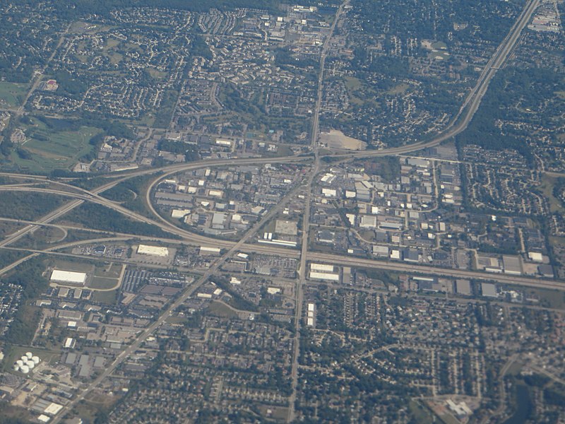
File:Farmington Hills, Michigan (21702330975).jpg

Original file (4,000 × 3,000 pixels, file size: 3.65 MB, MIME type: image/jpeg)
Captions
Captions
Summary edit
| DescriptionFarmington Hills, Michigan (21702330975).jpg |
Farmington Hills is an affluent community in southeastern Michigan. It is the second largest city in Oakland County in the U.S. state of Michigan. Its population was 79,740 at the 2010 census. It is part of the upscale northwestern suburbs of Metropolitan Detroit and is also 33 miles (53 km) northeast of downtown Ann Arbor. Farmington Hills consistently ranks as one of the safest cities in the United States, as well as in the state of Michigan. In 2010, the area ranked as the 30th safest city in America. Although the two cities have separate services and addresses, Farmington and Farmington Hills are often thought of as the same community. Features of the community include a recently renovated downtown, boutiques, a vintage cinema, numerous restaurants, exotic car dealerships, art galleries, and public parks including Heritage Park. There are several historical sites including the Longacre House and the Governor Warner Mansion. Both cities are served by Farmington Public Schools. Farmington Hills serves as a major business center for the greater Detroit area. Farmington Hills is the home of the Holocaust Memorial Center, the only Holocaust Memorial in the State of Michigan. The Center's mission is to educate the public about the tragedy and evils of the Holocaust. The Holocaust Memorial Center was originally located in neighboring West Bloomfield Township, but has since expanded and moved to its current facility. <a href="http://en.wikipedia.org/wiki/Farmington_Hills,_Michigan" rel="nofollow">en.wikipedia.org/wiki/Farmington_Hills,_Michigan</a> <a href="http://en.wikipedia.org/wiki/Wikipedia:Text_of_Creative_Commons_Attribution-ShareAlike_3.0_Unported_License" rel="nofollow">en.wikipedia.org/wiki/Wikipedia:Text_of_Creative_Commons_...</a> |
| Date | |
| Source | Farmington Hills, Michigan |
| Author | Ken Lund from Reno, Nevada, USA |
| Camera location | 42° 28′ 19.51″ N, 83° 25′ 32.41″ W | View this and other nearby images on: OpenStreetMap |
|---|
Licensing edit
- You are free:
- to share – to copy, distribute and transmit the work
- to remix – to adapt the work
- Under the following conditions:
- attribution – You must give appropriate credit, provide a link to the license, and indicate if changes were made. You may do so in any reasonable manner, but not in any way that suggests the licensor endorses you or your use.
- share alike – If you remix, transform, or build upon the material, you must distribute your contributions under the same or compatible license as the original.
| This image was originally posted to Flickr by Ken Lund at https://flickr.com/photos/75683070@N00/21702330975. It was reviewed on 8 November 2020 by FlickreviewR 2 and was confirmed to be licensed under the terms of the cc-by-sa-2.0. |
8 November 2020
File history
Click on a date/time to view the file as it appeared at that time.
| Date/Time | Thumbnail | Dimensions | User | Comment | |
|---|---|---|---|---|---|
| current | 19:32, 8 November 2020 |  | 4,000 × 3,000 (3.65 MB) | Orizan (talk | contribs) | Transferred from Flickr via #flickr2commons |
You cannot overwrite this file.
File usage on Commons
There are no pages that use this file.
Metadata
This file contains additional information such as Exif metadata which may have been added by the digital camera, scanner, or software program used to create or digitize it. If the file has been modified from its original state, some details such as the timestamp may not fully reflect those of the original file. The timestamp is only as accurate as the clock in the camera, and it may be completely wrong.
| Camera manufacturer | Canon |
|---|---|
| Camera model | Canon PowerShot SX280 HS |
| Exposure time | 1/400 sec (0.0025) |
| F-number | f/5 |
| ISO speed rating | 80 |
| Date and time of data generation | 11:28, 24 September 2015 |
| Lens focal length | 17.427 mm |
| Orientation | Normal |
| Horizontal resolution | 180 dpi |
| Vertical resolution | 180 dpi |
| File change date and time | 11:28, 24 September 2015 |
| Y and C positioning | Co-sited |
| Exif version | 2.3 |
| Date and time of digitizing | 11:28, 24 September 2015 |
| Meaning of each component |
|
| Image compression mode | 3 |
| APEX shutter speed | 8.65625 |
| APEX aperture | 4.65625 |
| APEX exposure bias | −0.33333333333333 |
| Maximum land aperture | 4.65625 APEX (f/5.02) |
| Metering mode | Pattern |
| Flash | Flash did not fire, compulsory flash suppression |
| Supported Flashpix version | 1 |
| Color space | sRGB |
| Focal plane X resolution | 16,393.442622951 |
| Focal plane Y resolution | 16,393.442622951 |
| Focal plane resolution unit | inches |
| Sensing method | One-chip color area sensor |
| File source | Digital still camera |
| Custom image processing | Custom process |
| Exposure mode | Manual exposure |
| White balance | Auto white balance |
| Digital zoom ratio | 1 |
| Scene capture type | Standard |
| GPS tag version | 0.0.3.2 |
| Rating (out of 5) | 0 |