File:Fay 2008 Appalachians rainfall.gif

Size of this preview: 800 × 506 pixels. Other resolutions: 320 × 202 pixels | 640 × 405 pixels | 1,024 × 648 pixels | 1,466 × 927 pixels.
Original file (1,466 × 927 pixels, file size: 43 KB, MIME type: image/gif)
Captions
Captions
Add a one-line explanation of what this file represents
Summary
| Description |
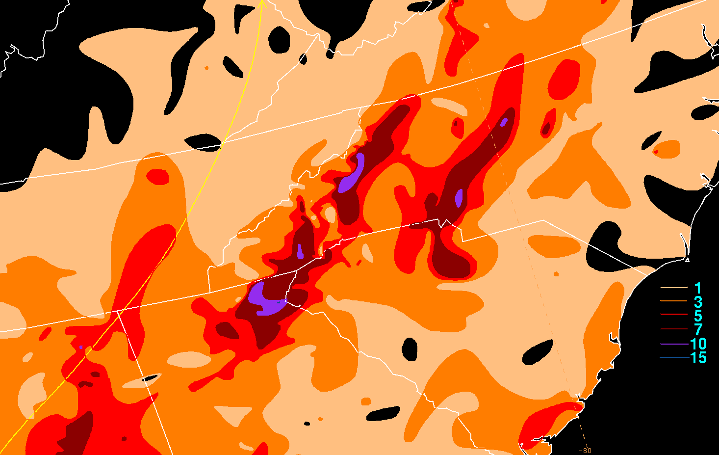
English: Storm total rainfall map of Tropical Storm Fay in the Appalachians during August 2008. |
|||
| Date | ||||
| Source | WPC tropical cyclone rainfall data | |||
| Author | David Roth, Weather Prediction Center, Camp Springs, Maryland | |||
| Permission (Reusing this file) |
|
File history
Click on a date/time to view the file as it appeared at that time.
| Date/Time | Thumbnail | Dimensions | User | Comment | |
|---|---|---|---|---|---|
| current | 22:09, 8 January 2013 | | 1,466 × 927 (43 KB) | Hurricanefan24 (talk | contribs) | {{HPC rainfall|Tropical Storm Fay (2008)|Tropical Storm Fay|August 2008|http://www.hpc.ncep.noaa.gov/tropical/rain/fay2008apfilledrainblk.gif|2008-09-01|true|Tropical Storm Fay (2008)|true|Appalachian Mountains{{!}}Appalachians}} |
You cannot overwrite this file.
File usage on Commons
There are no pages that use this file.