File:FermanaghShape.gif
No higher resolution available.
FermanaghShape.gif (532 × 405 pixels, file size: 10 KB, MIME type: image/gif)
Captions
Captions
Add a one-line explanation of what this file represents
Summary edit
| Description |
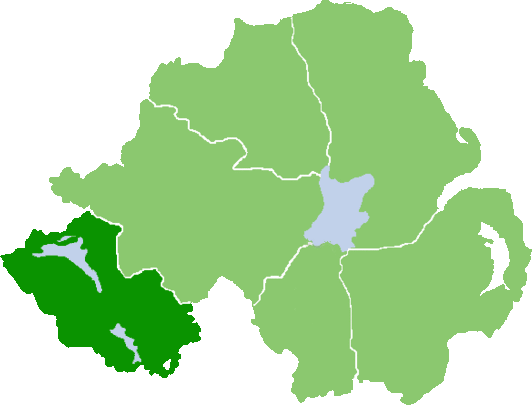
English: Outline map of County Fermanagh, Northern Ireland |
| Date | |
| Source | Own work (Original text: own work, based on :Image:NIShape.gif) |
| Author | User:Grutness, based on work of User:Setanta747 / Grutness at English Wikipedia |
Licensing edit
| This work has been released into the public domain by its author, Grutness at English Wikipedia. This applies worldwide. In some countries this may not be legally possible; if so: Grutness grants anyone the right to use this work for any purpose, without any conditions, unless such conditions are required by law. |
Original upload log edit
Transferred from en.wikipedia to Commons by Quadell using CommonsHelper.
The original description page was here. All following user names refer to en.wikipedia.
- 2008-07-07 07:59 Grutness 532×405× (10478 bytes) {{Information |Description=Outline map of County Fermanagh, Northern Ireland |Source=own work, based on [[:Image:NIShape.gif]] |Date=7/7/08 |Author=[[User:Grutness]], based on work of [[User:Setanta747]] |Permission={{PD-self}} |other_versions= }}
File history
Click on a date/time to view the file as it appeared at that time.
| Date/Time | Thumbnail | Dimensions | User | Comment | |
|---|---|---|---|---|---|
| current | 13:29, 25 July 2013 | | 532 × 405 (10 KB) | File Upload Bot (Magnus Manske) (talk | contribs) | Transfered from en.wikipedia by User:Quadell using CommonsHelper |
You cannot overwrite this file.
File usage on Commons
There are no pages that use this file.
File usage on other wikis
The following other wikis use this file:
- Usage on en.wikipedia.org
- Letterbreen
- Arney
- Bellanaleck
- Lisnarick, County Fermanagh
- Aughey
- Macken, County Fermanagh
- Skea, County Fermanagh
- Ballycassidy
- Laragh (Trory)
- Holywell, County Fermanagh
- Clabby
- Donagh
- Drumlaghy
- Lack, County Fermanagh
- Monea
- Springfield, County Fermanagh
- Tamlaght, County Fermanagh
- Teemore
- Lustymore Island
- Lusty Beg Island
- A509 road (Northern Ireland)
- Hanging Rock, County Fermanagh
- Lough MacNean
- Benaughlin Mountain
- Colebrooke River
- RAF Castle Archdale
- Template:Fermanagh-geo-stub
- Badger Pot
- Finn Bridge
- Derryvore
- A46 road (Northern Ireland)
- A34 road (Northern Ireland)
- Levally Lower
- Killydrum
- Carn, County Fermanagh
- Florence Court Forest Park
- Carr, County Fermanagh
- Clogherbog
- Glenkeel
- Kilnamadoo
- Knocknahunshin
- Tullygerravra
- Cliffs of Magho
- Termon River
- Moylehid
- Agharahan
- Drummacoorin
- Aghamore, County Fermanagh
- Aghaherrish
- Aghahoorin
View more global usage of this file.