File:Ferrybridge geograph-3516276-by-Ben-Brooksbank.jpg
Size of this preview: 800 × 466 pixels. Other resolutions: 320 × 187 pixels | 640 × 373 pixels | 1,024 × 597 pixels | 1,280 × 746 pixels | 2,336 × 1,362 pixels.
Original file (2,336 × 1,362 pixels, file size: 3.19 MB, MIME type: image/jpeg)
Captions
Captions
Add a one-line explanation of what this file represents
Summary
edit
| Description |
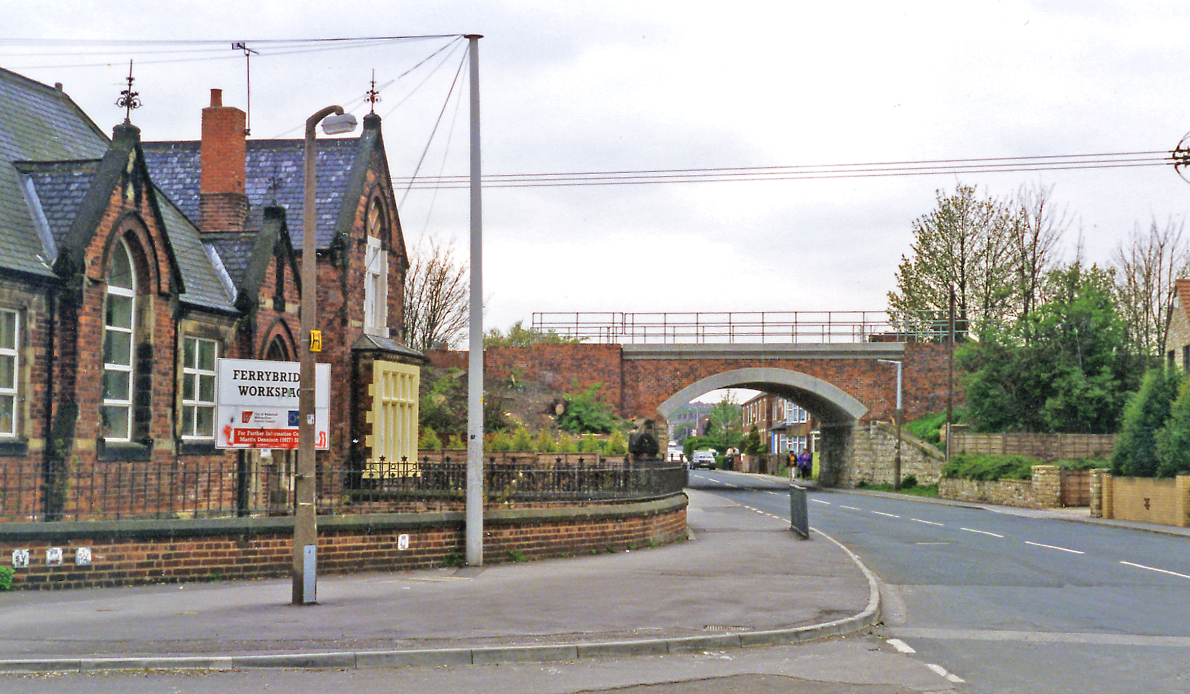
English: Ferrybridge: bridge on Pontefract Road under main lines at site of former station, 1995. View westward, under the main Swinton & Knottingley (ex-Midland & NE Joint) line from York via Church Fenton (to the right) to Pontefract and Sheffield (to the left). The station, which was up to the left, was purely for local purposes, being close to Pontefract and Knottingley, was closed 13/9/65, but the lines remain on busy routes |
| Date | |
| Source | From geograph.org.uk |
| Author | Ben Brooksbank |
| Permission (Reusing this file) |
Creative Commons Attribution Share-alike license 2.0 |
| Camera location | | View this and other nearby images on: OpenStreetMap |
|---|
Licensing
edit

|
This image was taken from the Geograph project collection. See this photograph's page on the Geograph website for the photographer's contact details. The copyright on this image is owned by Ben Brooksbank and is licensed for reuse under the Creative Commons Attribution-ShareAlike 2.0 license.
|
This file is licensed under the Creative Commons Attribution-Share Alike 2.0 Generic license.
Attribution: Ben Brooksbank
- You are free:
- to share – to copy, distribute and transmit the work
- to remix – to adapt the work
- Under the following conditions:
- attribution – You must give appropriate credit, provide a link to the license, and indicate if changes were made. You may do so in any reasonable manner, but not in any way that suggests the licensor endorses you or your use.
- share alike – If you remix, transform, or build upon the material, you must distribute your contributions under the same or compatible license as the original.
File history
Click on a date/time to view the file as it appeared at that time.
| Date/Time | Thumbnail | Dimensions | User | Comment | |
|---|---|---|---|---|---|
| current | 06:44, 27 July 2013 | | 2,336 × 1,362 (3.19 MB) | Chevin (talk | contribs) | == {{int:filedesc}} == {{Information |Description={{en|1='''Ferrybridge: bridge on Pontefract Road under main lines at site of former station, 1995.'''<br/> View westward, under the main Swinton & Knottingley (ex-Midland & NE Joint) line from York via ... |
You cannot overwrite this file.
File usage on Commons
There are no pages that use this file.