File:Festungsplan Freudenstadt.jpg

Size of this preview: 800 × 569 pixels. Other resolutions: 320 × 227 pixels | 640 × 455 pixels | 1,024 × 728 pixels | 1,280 × 910 pixels | 1,944 × 1,382 pixels.
Original file (1,944 × 1,382 pixels, file size: 579 KB, MIME type: image/jpeg)
Captions
Captions
Add a one-line explanation of what this file represents
Summary
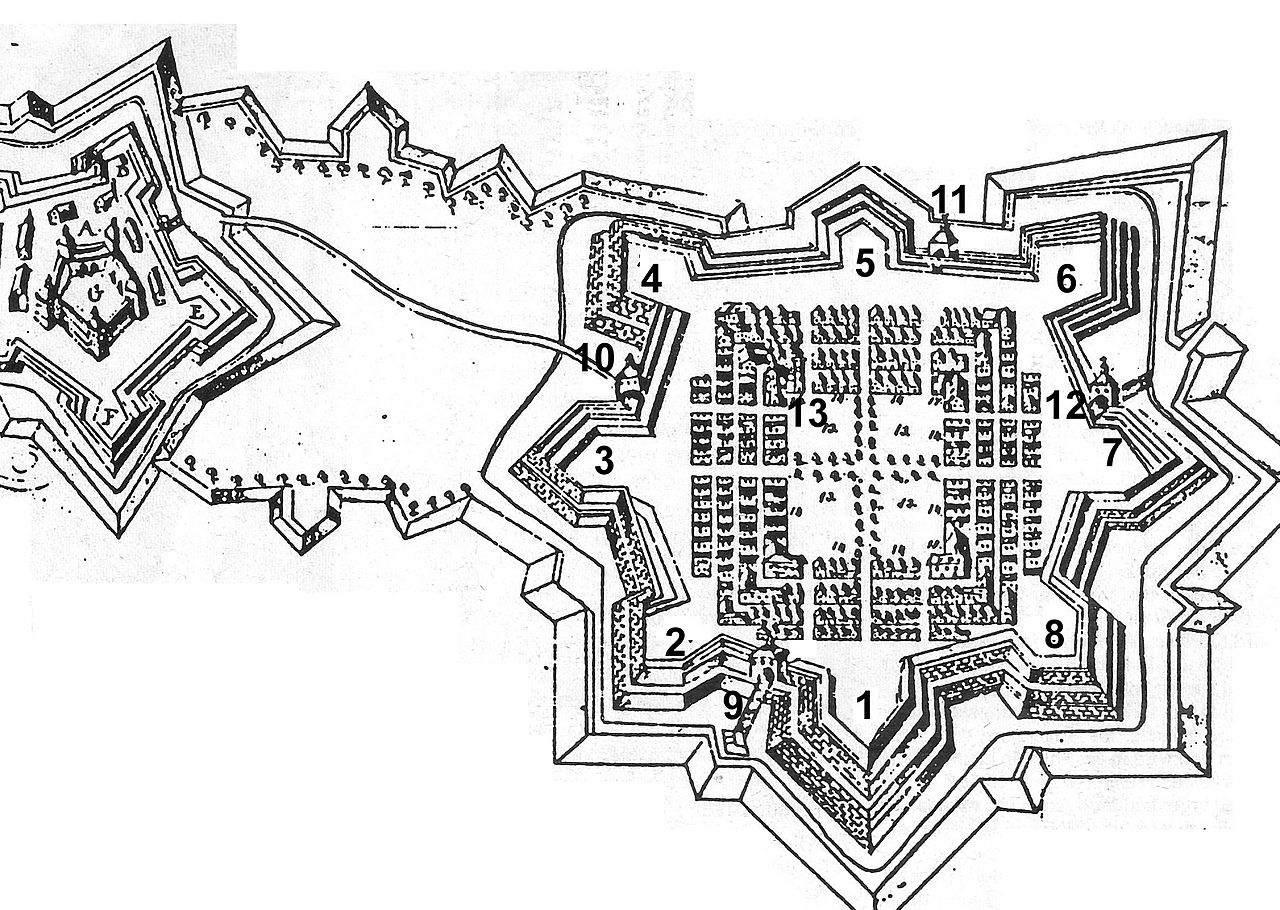
edit| Description |
Deutsch: Grundriss der Festung Freudenstadt |
|||||||||||||||||||||||||
| Date | (original: circa 1670) | |||||||||||||||||||||||||
| Source | Walter Kull: Freudenstädter Beiträge zur geschichtlichen Landeskunde zwischen Neckar, Murg und Kinzig, Festung Freudenstadt, Hrsg. Heimat- und Museumsverein für Stadt und Kreis Freudenstadt, 1985 | |||||||||||||||||||||||||
| Author |
D. F. Bothner (drawing/Zeichnung)
|
|||||||||||||||||||||||||
| Other versions |
|
|||||||||||||||||||||||||
.jpg)
Licensing
edit
|
This work is in the public domain in its country of origin and other countries and areas where the copyright term is the author's life plus 100 years or fewer. | |
| This file has been identified as being free of known restrictions under copyright law, including all related and neighboring rights. | |
File history
Click on a date/time to view the file as it appeared at that time.
| Date/Time | Thumbnail | Dimensions | User | Comment | |
|---|---|---|---|---|---|
| current | 12:32, 13 January 2015 | | 1,944 × 1,382 (579 KB) | UlrichClassen (talk | contribs) | User created page with UploadWizard |
You cannot overwrite this file.
File usage on Commons
There are no pages that use this file.