File:Fig 17 Map showing drainage of no Montana.jpg
Size of this preview: 800 × 589 pixels. Other resolutions: 320 × 236 pixels | 640 × 471 pixels | 1,024 × 754 pixels | 1,280 × 942 pixels | 1,448 × 1,066 pixels.
Original file (1,448 × 1,066 pixels, file size: 203 KB, MIME type: image/jpeg)
Captions
Captions
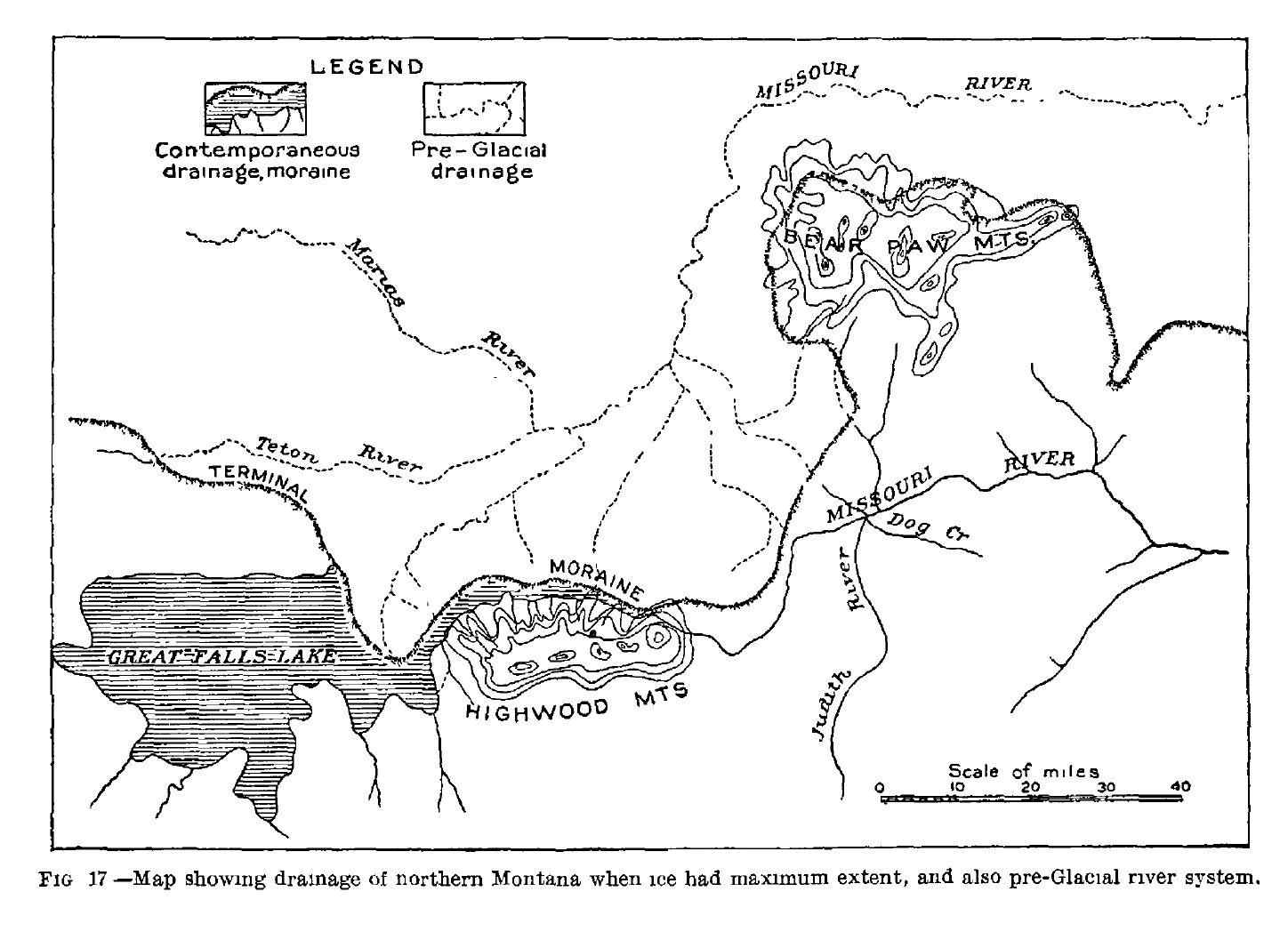
Fig 17 Map showing drainage of no Montana
Summary
edit
| Description |
English: Fig 17 Map showing drainage of no Montana |
| Date | |
| Source | Fred. H. H. Calhoun Sr.; The Montana Lobe of the Keewatin Ice Sheet; Professional Paper No 50 Series B, Descriptive Geology, 79; Department of the Interior, United States Geological Survey, Charles D. Walcott, Director; Washington, D.C.; Government Printing Office; 1906 |
| Author | Fred. H. H. Calhoun Sr. |
Licensing
edit
This work is in the public domain in the United States because it is a work prepared by an officer or employee of the United States Government as part of that person’s official duties under the terms of Title 17, Chapter 1, Section 105 of the US Code.
Note: This only applies to original works of the Federal Government and not to the work of any individual U.S. state, territory, commonwealth, county, municipality, or any other subdivision. This template also does not apply to postage stamp designs published by the United States Postal Service since 1978. (See § 313.6(C)(1) of Compendium of U.S. Copyright Office Practices). It also does not apply to certain US coins; see The US Mint Terms of Use.
|
 | |
| This file has been identified as being free of known restrictions under copyright law, including all related and neighboring rights. | ||
File history
Click on a date/time to view the file as it appeared at that time.
| Date/Time | Thumbnail | Dimensions | User | Comment | |
|---|---|---|---|---|---|
| current | 20:15, 17 April 2020 | | 1,448 × 1,066 (203 KB) | Chris Light (talk | contribs) | Uploaded a work by Fred. H. H. Calhoun Sr. from Fred. H. H. Calhoun Sr.; The Montana Lobe of the Keewatin Ice Sheet; Professional Paper No 50 Series B, Descriptive Geology, 79; Department of the Interior, United States Geological Survey, Charles D. Walcott, Director; Washington, D.C.; Government Printing Office; 1906 with UploadWizard |
You cannot overwrite this file.
File usage on Commons
There are no pages that use this file.