File:Figurative cartouche on a Curdistan map by Mallett.jpg
No higher resolution available.
Figurative_cartouche_on_a_Curdistan_map_by_Mallett.jpg (356 × 354 pixels, file size: 113 KB, MIME type: image/jpeg)
Captions
Captions
Add a one-line explanation of what this file represents
Summary edit
| Description |
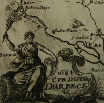
English: contrary to [Figurative cartouche on a Curdistan map by Mallett.jpg], the scanned map states that the map was drawn 1684 |
|||||||||||||||||||||||
| Date | ||||||||||||||||||||||||
| Source | www.columbia.edu | |||||||||||||||||||||||
| Author |
|
|||||||||||||||||||||||
| Other versions | ||||||||||||||||||||||||
.jpg)
.jpg)
Licensing edit
|
This is a faithful photographic reproduction of a two-dimensional, public domain work of art. The work of art itself is in the public domain for the following reason:
The official position taken by the Wikimedia Foundation is that "faithful reproductions of two-dimensional public domain works of art are public domain".
This photographic reproduction is therefore also considered to be in the public domain in the United States. In other jurisdictions, re-use of this content may be restricted; see Reuse of PD-Art photographs for details. | ||||
File history
Click on a date/time to view the file as it appeared at that time.
| Date/Time | Thumbnail | Dimensions | User | Comment | |
|---|---|---|---|---|---|
| current | 15:37, 23 November 2022 | | 356 × 354 (113 KB) | Enyavar (talk | contribs) | File:Map of the Iraq region, Description de L'Universe (Alain Manesson Mallet, 1685).jpg cropped 43 % horizontally, 61 % vertically using CropTool with precise mode. |
You cannot overwrite this file.
File usage on Commons
The following page uses this file: