File:Final Right Curve on Keio Sagamihara Line.jpg
Size of this preview: 800 × 600 pixels. Other resolutions: 320 × 240 pixels | 640 × 480 pixels | 1,024 × 768 pixels | 1,280 × 960 pixels | 1,603 × 1,202 pixels.
Original file (1,603 × 1,202 pixels, file size: 408 KB, MIME type: image/jpeg)
Captions
Captions
Add a one-line explanation of what this file represents
Summary edit
| Description |
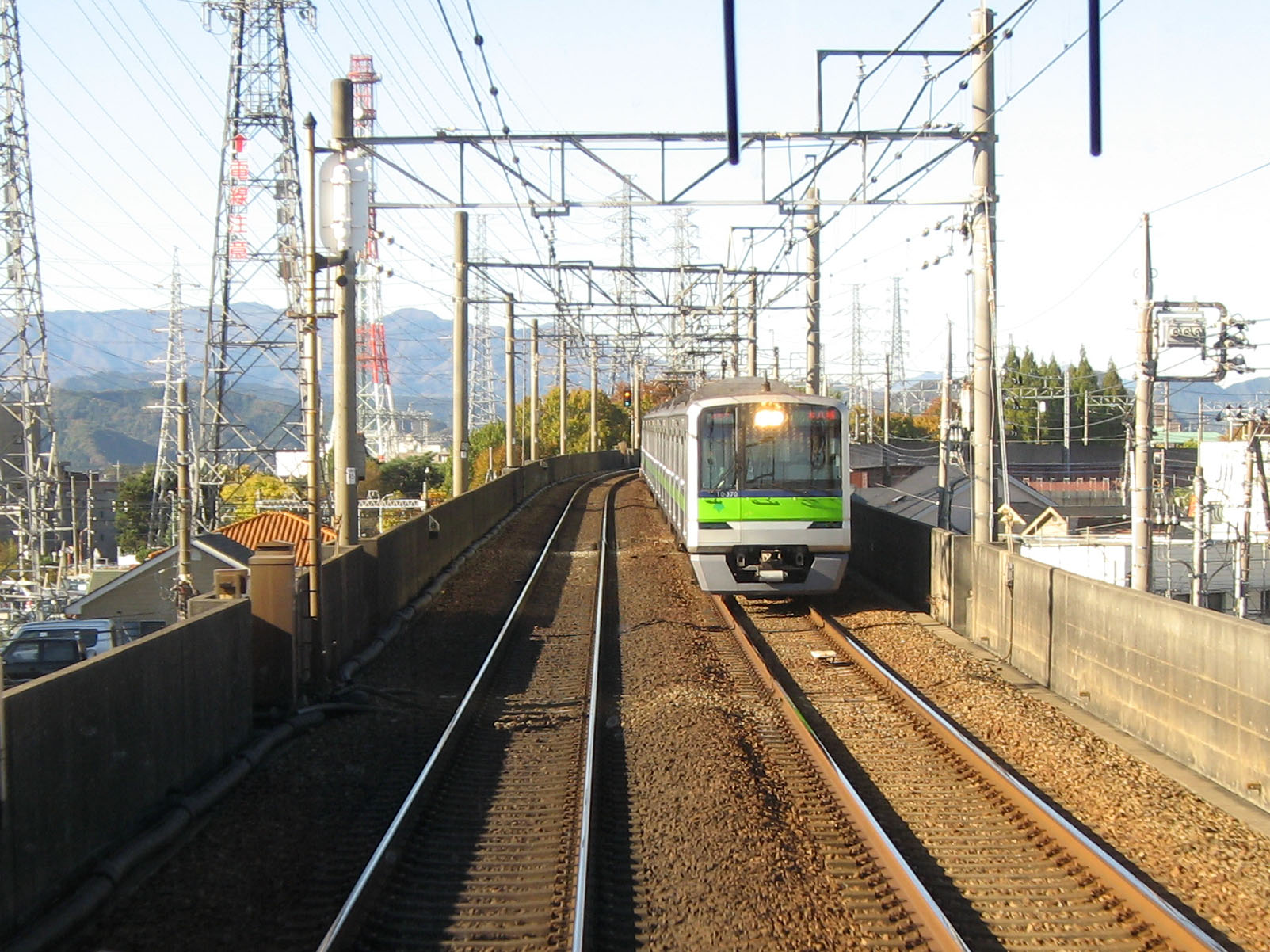
日本語: 京王相模原線の終端橋本駅に向かう際の最後の右カーブ(神奈川県相模原市)。対向車両は、東京都交通局10-300形。 English: The last right curve approaching to Hashimoto Station on Keio Sagamihara Line in Sagamihara, Kanagawa, Japan. |
| Date | 19 November 2008, 09:22 |
| Source | Own work |
| Author | Nikm |
| Camera location | | View this and other nearby images on: OpenStreetMap |
|---|
Licensing edit
| I, the copyright holder of this work, release this work into the public domain. This applies worldwide. In some countries this may not be legally possible; if so: I grant anyone the right to use this work for any purpose, without any conditions, unless such conditions are required by law. |
File history
Click on a date/time to view the file as it appeared at that time.
| Date/Time | Thumbnail | Dimensions | User | Comment | |
|---|---|---|---|---|---|
| current | 08:36, 5 December 2009 | | 1,603 × 1,202 (408 KB) | Nikm (talk | contribs) | {{Information |Description={{en|1=The last right curve approaching to Hashimoto Station on Keio Sagamihara Line in Sagamihara, Kanagawa, Japan.}} {{ja|1=京王相模原線の終端橋本駅に向かう際の最後の右カーブ |
You cannot overwrite this file.
File usage on Commons
There are no pages that use this file.