File:Fire Control Study - DPLA - 4f0ed9c63418f5a5a5d37c720cfe5ae7.jpg

Size of this preview: 800 × 467 pixels. Other resolutions: 320 × 187 pixels | 640 × 373 pixels | 1,024 × 598 pixels | 1,280 × 747 pixels | 2,560 × 1,494 pixels | 6,557 × 3,826 pixels.
Original file (6,557 × 3,826 pixels, file size: 3.5 MB, MIME type: image/jpeg)
Captions
Captions
Add a one-line explanation of what this file represents
Summary
edit| Fire Control Study
( |
||||||||||||||||||||
|---|---|---|---|---|---|---|---|---|---|---|---|---|---|---|---|---|---|---|---|---|
| Creator | Published by North Carolina Department of Conservation and Development | |||||||||||||||||||
| Title |
Fire Control Study |
|||||||||||||||||||
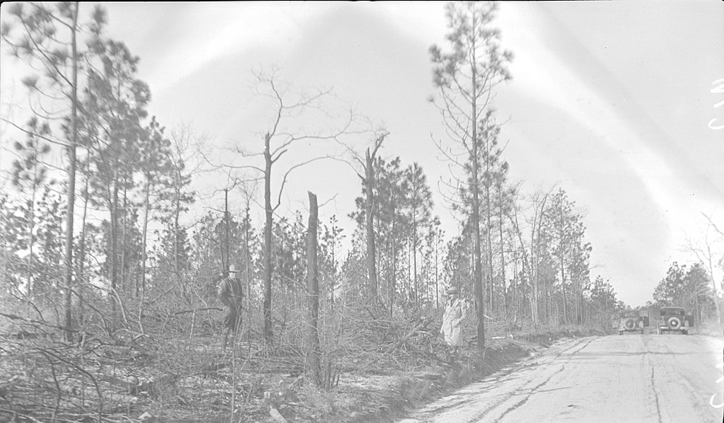
| Description |
Fire Hazard along County Road: Near Warden Barber's residence Scotland Co. Tree laps from clearing R/W piled on edge of road.; On slide: "Location: Fire Hazard along County Road" |
|||||||||||||||||||
| Date | 21 February 1933 | |||||||||||||||||||
| Collection |
|
|||||||||||||||||||
| Source/Photographer |
|
|||||||||||||||||||
| Permission (Reusing this file) |
|
|||||||||||||||||||
| Standardized rights statement |
|
|||||||||||||||||||


File history
Click on a date/time to view the file as it appeared at that time.
| Date/Time | Thumbnail | Dimensions | User | Comment | |
|---|---|---|---|---|---|
| current | 01:22, 20 February 2020 | | 6,557 × 3,826 (3.5 MB) | DPLA bot (talk | contribs) | Uploading DPLA ID 4f0ed9c63418f5a5a5d37c720cfe5ae7 |
You cannot overwrite this file.
File usage on Commons
The following page uses this file: