File:Fires in northern Australia (MODIS 2016-07-30).jpg

Original file (4,800 × 3,600 pixels, file size: 3.12 MB, MIME type: image/jpeg)
Captions
Captions
Summary
edit.jpg&action=edit§ion=1)
| Description |
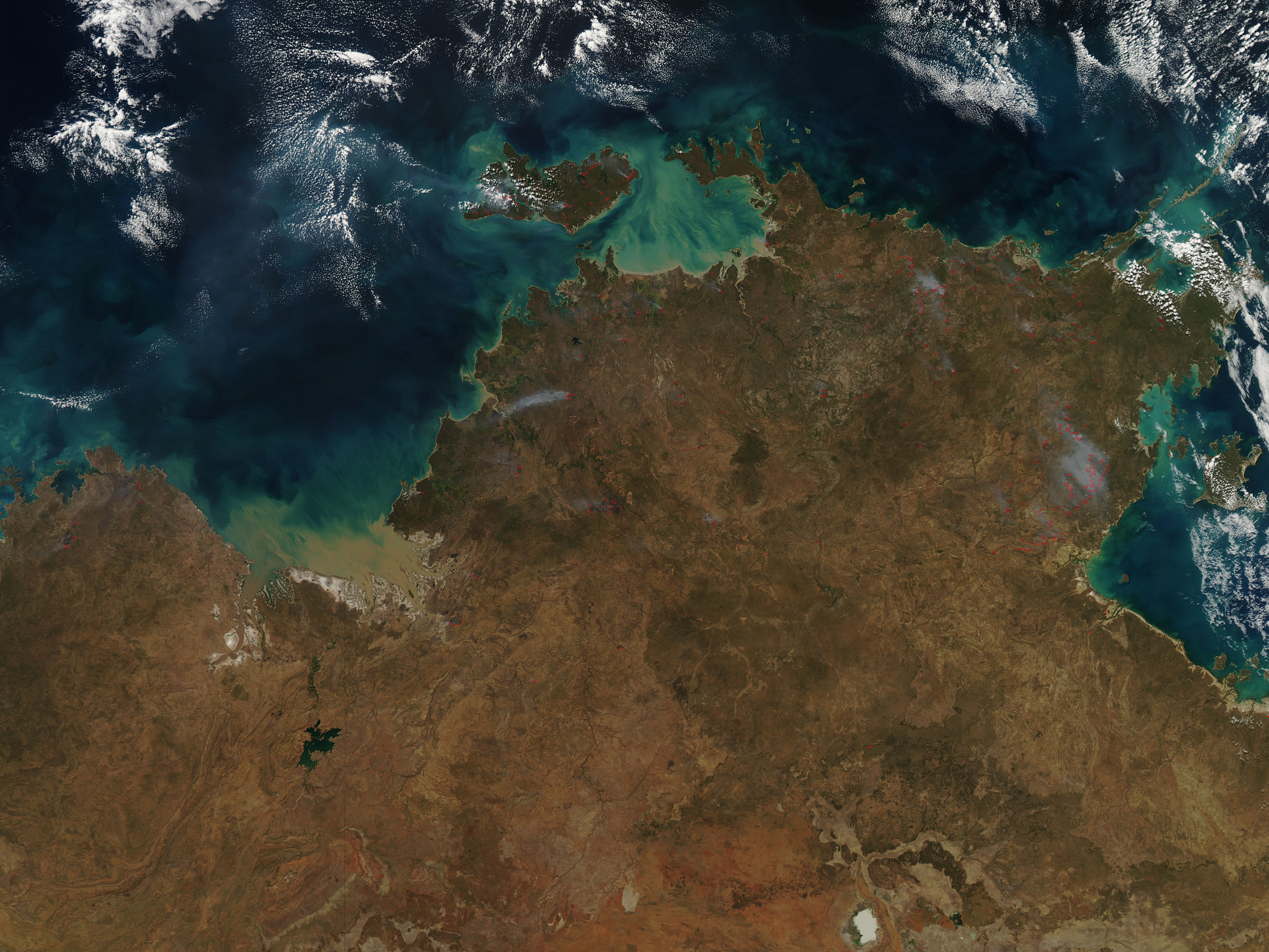
English: Fires speckled the landscape across northern Australia in mid-July 2016. The Moderate Resolution Imaging Spectroradiometer (MODIS) aboard NASA’s Aqua satellite captured a true-color image on July 20.
Each red hot spot marks an area where the thermal sensors on the MODIS instrument detected temperatures higher than background. When combined with typical smoke, as in this image, such hot spots are diagnostic for actively burning fire. Most of the fires cluster in the northern section of Northern Territory, with several fires also located in northern Western Australia. Bushfires are an annual occurrence in this region, peaking in the dry, warm weather from June through September. The winter of 2016 in parts of northern Australia have been especially hot, dry, and windy – perfect conditions for bushfire ignition and growth. On July 28 the Australian Government’s Bureau of Meteorology issued a Fire Weather Warning stating “a high pressure system moving into South Australia extends a ridge over central Australia and is bringing dry, moderately southeasterly winds to much of the Territory, tending fresh and gusty during the day”. The gusting, dry winds increases fire activity and spread. This was followed by a warning on July 29 which forecast severe fire danger for the Darwin and Adelaide River areas. The risk is so severe that a fire ban was issued for the Darwin and Adelaide River Fire Weather Forecast area from 5:00 am Thursday, July 2016 until 5:00 am Friday, July 29. A ban means “No person shall light a fire or cause a fire to be lit in the open in the portion of the Northern Territory within the fire ban areas”. |
||
| Date | Taken on 20 July 2016 | ||
| Source |
Fires in northern Australia (direct link)
|
||
| Author | Jeff Schmaltz, MODIS Land Rapid Response Team, NASA GSFC |
| This media is a product of the Aqua mission Credit and attribution belongs to the mission team, if not already specified in the "author" row |
Licensing
edit.jpg&action=edit§ion=2)
| This file is in the public domain in the United States because it was solely created by NASA. NASA copyright policy states that "NASA material is not protected by copyright unless noted". (See Template:PD-USGov, NASA copyright policy page or JPL Image Use Policy.) | ||
 |
Warnings:
|
File history
Click on a date/time to view the file as it appeared at that time.
| Date/Time | Thumbnail | Dimensions | User | Comment | |
|---|---|---|---|---|---|
| current | 19:25, 15 February 2024 | | 4,800 × 3,600 (3.12 MB) | OptimusPrimeBot (talk | contribs) | #Spacemedia - Upload of http://modis.gsfc.nasa.gov/gallery/images/image07302016_250m.jpg via Commons:Spacemedia |
You cannot overwrite this file.
File usage on Commons
There are no pages that use this file.
.jpg&oldid=852068967)