File:Fires in northern California (afternoon overpass) (MODIS 2017-10-18).jpg

Original file (2,800 × 3,600 pixels, file size: 1.36 MB, MIME type: image/jpeg)
Captions
Captions
Summary
edit_(MODIS_2017-10-18).jpg&action=edit§ion=1)
| Description |
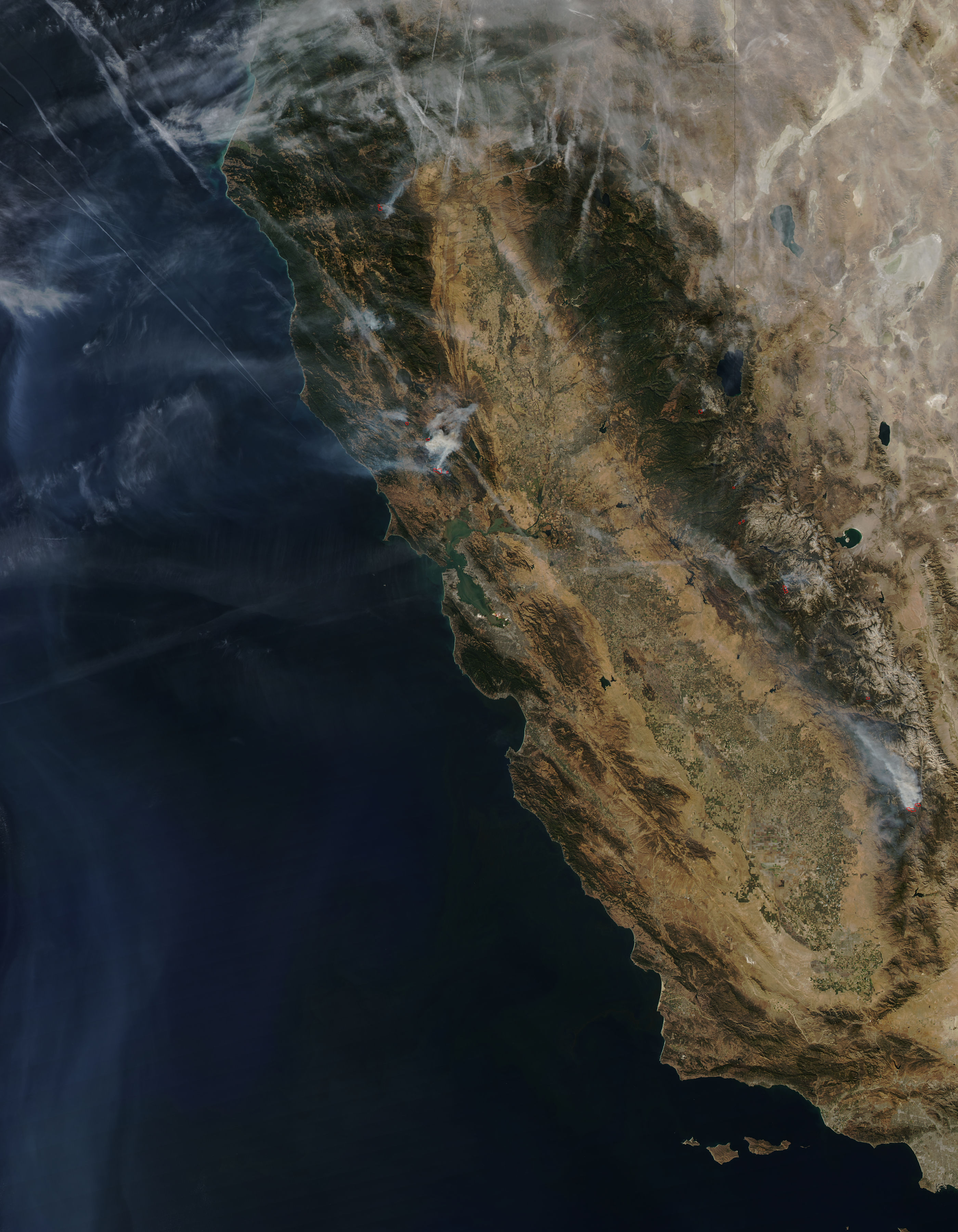
English: On October 15, 2017, the Moderate Resolution Imaging Spectroradiometer (MODIS) aboard NASA’s Aqua satellite flew over Northern California and acquired a true-color image of widespread smoke and numerous actively-burning wildfires.
High temperatures, low humidity, dry conditions, and strong winds combined to make northern California, especially around the Napa and Sonoma Valleys, a tinderbox. When fires ignited on October 8, they grew explosively, sweeping across towns and countryside. As of October 17, Cal Fire reports that more than 245,000 acres have burned across California, and 11,000 firefighters were working the 12 major fires currently active. 41 people have died due to this wildfire outbreak and more than 5,700 structures were destroyed. On October 15, the strong winds began to weaken and shift. According to the California Smoke Info website, on that date, the winds which had previously been strong and easterly (pushing smoke to the west), gradually swung clockwise and became southwesterly by late afternoon. The winds had previously been pushing the bulk of the smoke over the Pacific Ocean, but the shifting winds spread smoke across the state, as can be seen in this image. On October 17, the wildfires continued to burn across Northern California. Good progress was made around October 15, when the winds lightened and humidity increased with the appearance of rain. Currently the forecast is for strengthening winds and dropping humidity, which will make conditions more difficult for firefighters as they work to contain and douse the blazes. |
||
| Date | Taken on 15 October 2017 | ||
| Source |
Fires in northern California (afternoon overpass) (direct link)
|
||
| Author | Jeff Schmaltz, MODIS Land Rapid Response Team, NASA GSFC |
| This media is a product of the Aqua mission Credit and attribution belongs to the mission team, if not already specified in the "author" row |
Licensing
edit_(MODIS_2017-10-18).jpg&action=edit§ion=2)
| This file is in the public domain in the United States because it was solely created by NASA. NASA copyright policy states that "NASA material is not protected by copyright unless noted". (See Template:PD-USGov, NASA copyright policy page or JPL Image Use Policy.) | ||
 |
Warnings:
|
File history
Click on a date/time to view the file as it appeared at that time.
| Date/Time | Thumbnail | Dimensions | User | Comment | |
|---|---|---|---|---|---|
| current | 17:32, 16 February 2024 | | 2,800 × 3,600 (1.36 MB) | OptimusPrimeBot (talk | contribs) | #Spacemedia - Upload of http://modis.gsfc.nasa.gov/gallery/images/image10182017_250m.jpg via Commons:Spacemedia |
You cannot overwrite this file.
File usage on Commons
There are no pages that use this file.
_(MODIS_2017-10-18).jpg&oldid=880858806)