File:Fires near Fairbanks, Alaska (MODIS 2021-06-18).jpg

Original file (6,422 × 4,948 pixels, file size: 19.15 MB, MIME type: image/jpeg)
Captions
Captions
Summary edit
.jpg&action=edit§ion=1)
| Description |
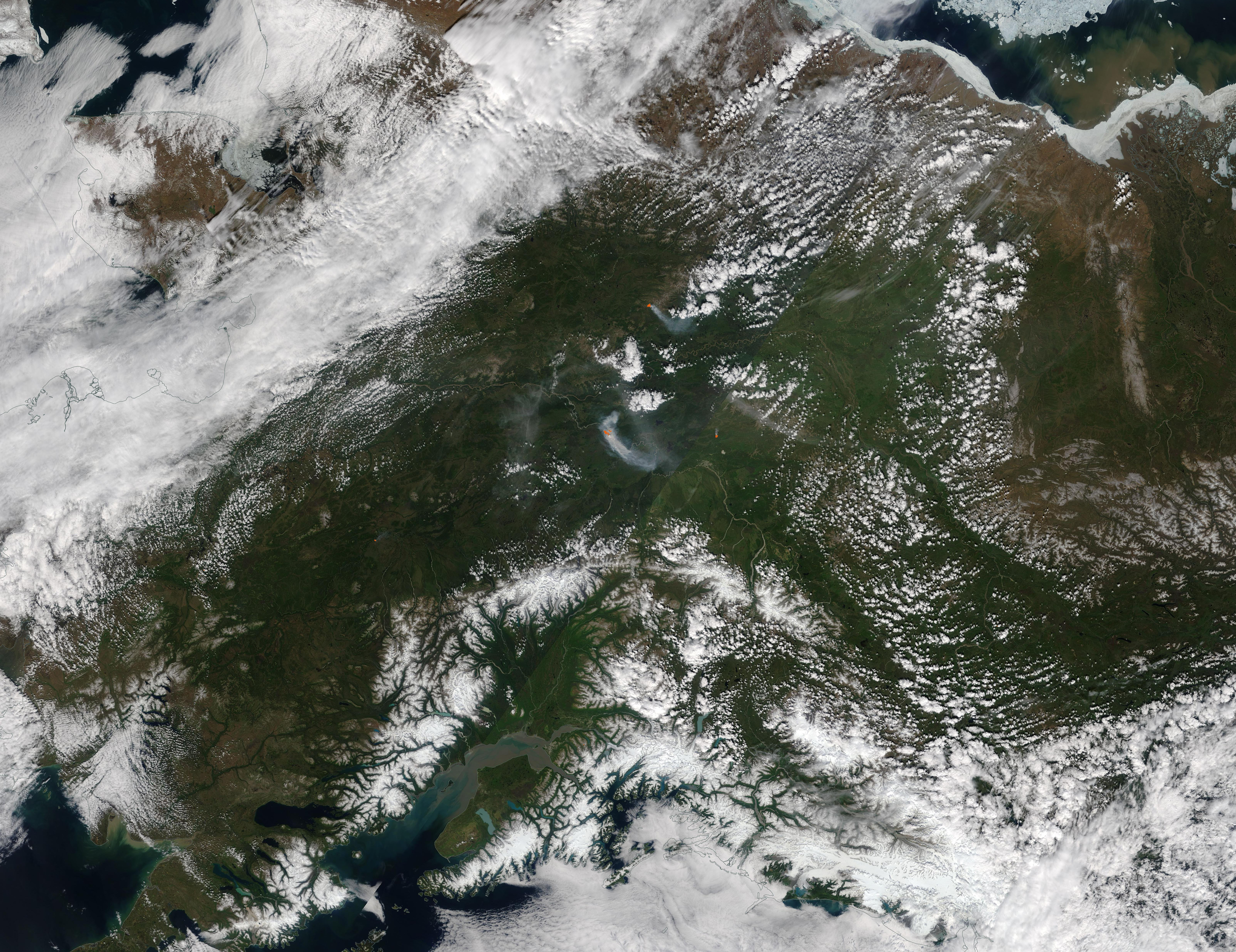
English: The Alaska summer fire season was heating up by mid-June 2021. According to the Alaska Interagency Coordination Center (AICC) Wildland Fire Dashboard, as of June 17 there were 34 fires burning in the state over the last week, with 20 new fires reported in the last 24 hours. Since the beginning of the year, 207 fires have affected 19,015 acres of Alaskan Wildland.
On June 15, 2021, the Moderate Resolution Imaging Spectroradiometer (MODIS) on board NASA’s Terra satellite acquired a true-color image of several large fires near Fairbanks, Alaska. Each red “hot spot” marks an area where the thermal bands on the MODIS instrument detected temperatures higher than normal. When combined with typical smoke, as in this image, such hot spots mark actively burning fires. The two largest fires in this region are the Haystack and the Winter Trail fires, both burning close to Fairbanks. An outbreak of dry lightning ignited at least eight fires on June 14-15, including the Haystack and the Winter Trail blazes. The Haystack Fire has been burning ominously close to a subdivision, getting within about a mile of the homes. Fortunately, winds were blowing towards the northwest, pushing the fire away from the Haystack subdivision and allowing firefighters to succeed in protecting that area. As of June 17, AICC reports that the Haystack fire has burned 896.5 acres and has been showing “extreme” fire behavior, with spotting, flanking, and backing. The fire is currently about 40 percent contained. The Winter Trail Fire began with a lightning strike on June 14 about 16 miles northeast of Fairbanks and less than a mile from Fort Knox Gold Mine. As of June 17, the fire had affected about 20 acres. Fire behavior was described as “moderate” by AICC, with smoldering and isolated torching. It has been about 20 percent contained. |
||
| Date | Taken on 15 June 2021 | ||
| Source |
Fires near Fairbanks, Alaska (direct link)
|
||
| Author | MODIS Land Rapid Response Team, NASA GSFC |
| This media is a product of the Terra mission Credit and attribution belongs to the mission team, if not already specified in the "author" row |
Licensing edit
.jpg&action=edit§ion=2)
| This file is in the public domain in the United States because it was solely created by NASA. NASA copyright policy states that "NASA material is not protected by copyright unless noted". (See Template:PD-USGov, NASA copyright policy page or JPL Image Use Policy.) | ||
 |
Warnings:
|
File history
Click on a date/time to view the file as it appeared at that time.
| Date/Time | Thumbnail | Dimensions | User | Comment | |
|---|---|---|---|---|---|
| current | 17:42, 30 January 2024 | | 6,422 × 4,948 (19.15 MB) | OptimusPrimeBot (talk | contribs) | #Spacemedia - Upload of http://modis.gsfc.nasa.gov/gallery/images/image06182021_250m.jpg via Commons:Spacemedia |
You cannot overwrite this file.
File usage on Commons
There are no pages that use this file.
.jpg&oldid=847255473)