File:First aerial circumnavigation 1924.png
Size of this preview: 800 × 449 pixels. Other resolutions: 320 × 180 pixels | 640 × 359 pixels | 1,024 × 575 pixels | 1,638 × 920 pixels.
Original file (1,638 × 920 pixels, file size: 1.05 MB, MIME type: image/png)
Captions
Captions
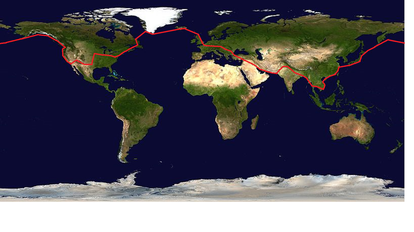
Itinerary of first aerial circumnavigation
Summary edit
| Description | Itinerary of first aerial circumnavigation 1924, created by me, User:Proofreader, using File:Whole world - land and oceans.jpg and Paint |
| Date | |
| Source | NASA Earth Observatory (NASA Goddard Space Flight Center) |
| Author | User:Proofreader |
Licensing edit
| This file is in the public domain in the United States because it was solely created by NASA. NASA copyright policy states that "NASA material is not protected by copyright unless noted". (See Template:PD-USGov, NASA copyright policy page or JPL Image Use Policy.) | ||
 |
Warnings:
|
File history
Click on a date/time to view the file as it appeared at that time.
| Date/Time | Thumbnail | Dimensions | User | Comment | |
|---|---|---|---|---|---|
| current | 14:06, 18 November 2020 | | 1,638 × 920 (1.05 MB) | Proofreader (talk | contribs) | {{Information |Description=Itinerary of first aerial circumnavigation 1924, created by me, User:Proofreader, using File:Whole world - land and oceans.jpg and Paint |Source=NASA Earth Observatory (NASA Goddard Space Flight Center) |Date=18 November 2020 |Author=User:Proofreader |Permission= |other_versions= }} |
You cannot overwrite this file.
File usage on Commons
The following page uses this file:
File usage on other wikis
The following other wikis use this file:
- Usage on en.wikipedia.org
- Usage on sv.wikipedia.org