File:Fiskartorpet map 1791.jpg
No higher resolution available.
Fiskartorpet_map_1791.jpg (790 × 330 pixels, file size: 98 KB, MIME type: image/jpeg)
Captions
Captions
Add a one-line explanation of what this file represents
Summary
edit
| Description |
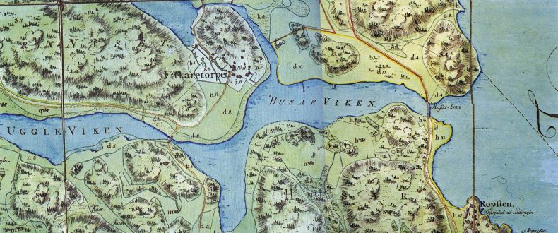
Historical map from 1791 showing the area around Fiskartorpet, a part of Norra Djurgården, Stockholm. The map is from 1791. |
| Date | Uploaded dec. 2007 |
| Source | [1] |
| Creator |
Lidingo 10:48, 10 December 2007 (UTC) |
| Permission (Reusing this file) |
PD-old |
| Georeferencing |
Licensing
edit
|
This work is in the public domain in its country of origin and other countries and areas where the copyright term is the author's life plus 70 years or fewer. | |
| This file has been identified as being free of known restrictions under copyright law, including all related and neighboring rights. | |
File history
Click on a date/time to view the file as it appeared at that time.
| Date/Time | Thumbnail | Dimensions | User | Comment | |
|---|---|---|---|---|---|
| current | 10:48, 10 December 2007 | | 790 × 330 (98 KB) | Lidingo (talk | contribs) | {{Information |Description= Historical map from 1791 showing the area around Fiskartorpet, a part of Norra Djurgården, Stockholm. The map is from 1791. |Source= [http://www.hjorthagen.nu/husarviken.htm] |Date= Uploaded dec. 2007 |Author= ~~~~ |Permissio |
You cannot overwrite this file.
File usage on Commons
There are no pages that use this file.