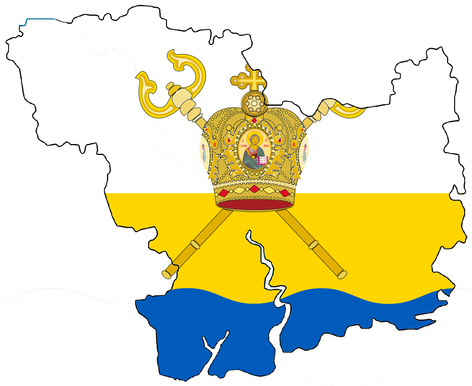
File:Flag-map of Mykolaiv Oblast.png
Size of this preview: 733 × 600 pixels. Other resolutions: 294 × 240 pixels | 587 × 480 pixels | 939 × 768 pixels | 1,252 × 1,024 pixels | 1,648 × 1,348 pixels.
Original file (1,648 × 1,348 pixels, file size: 298 KB, MIME type: image/png)
Captions
Captions
Add a one-line explanation of what this file represents

|
This flag map image could be re-created using vector graphics as an SVG file. This has several advantages; see Commons:Media for cleanup for more information. If an SVG form of this image is available, please upload it and afterwards replace this template with
{{vector version available|new image name}}.
It is recommended to name the SVG file “Flag-map of Mykolaiv Oblast.svg”—then the template Vector version available (or Vva) does not need the new image name parameter. |
Summary edit
| Description |
English: Nikolaev oblast
Русский: Николаевская область шаблон незавершённая статья по географии |
| Date | |
| Source | своя работа |
| Author | velesss |
Licensing edit
I, the copyright holder of this work, hereby publish it under the following licenses:

|
Permission is granted to copy, distribute and/or modify this document under the terms of the GNU Free Documentation License, Version 1.2 or any later version published by the Free Software Foundation; with no Invariant Sections, no Front-Cover Texts, and no Back-Cover Texts. A copy of the license is included in the section entitled GNU Free Documentation License. |
This file is licensed under the Creative Commons Attribution 3.0 Unported license.
- You are free:
- to share – to copy, distribute and transmit the work
- to remix – to adapt the work
- Under the following conditions:
- attribution – You must give appropriate credit, provide a link to the license, and indicate if changes were made. You may do so in any reasonable manner, but not in any way that suggests the licensor endorses you or your use.
You may select the license of your choice.
File history
Click on a date/time to view the file as it appeared at that time.
| Date/Time | Thumbnail | Dimensions | User | Comment | |
|---|---|---|---|---|---|
| current | 09:44, 12 June 2015 | | 1,648 × 1,348 (298 KB) | Andrew J.Kurbiko (talk | contribs) | upd |
| 16:56, 29 January 2011 |  | 188 × 161 (16 KB) | Velesss (talk | contribs) | {{Information |Description ={{en|1=Nikolaev oblast}} {{ru|1=Николаевская область шаблон незавершённая статья по географии}} |Source =своя работа |Author =velesss |Date |
You cannot overwrite this file.
File usage on Commons
The following 3 pages use this file:
File usage on other wikis
The following other wikis use this file:
- Usage on www.wikidata.org
- Usage on zh.wikipedia.org
- 卡贊卡
- 卡贊卡區
- 克里韋奧澤羅
- 克里韋奧澤羅區
- 新布赫區
- 新敖德薩區
- 奧恰基夫區
- 斯尼胡里夫卡區
- 阿爾布津卡
- 阿爾布津卡區
- 別列贊卡
- 別列贊卡區
- 贝雷兹内胡瓦泰
- 貝雷茲內胡瓦泰區
- 布拉茨凱
- 布拉茨凱區
- 韋塞利諾韋區
- 弗拉迪伊夫卡
- 弗拉迪伊夫卡區
- 多馬尼夫卡
- 多馬尼夫卡區
- 托卡里夫卡 (市級鎮)
- 亞歷山德里夫卡 (尼古拉耶夫州市級鎮)
- 奧利尚斯凱
- 五一鎮 (尼古拉耶夫區)
- 皮德霍罗德纳
- 新彼得里夫卡 (沃茲涅先斯克區)
- 新薩夫羅尼夫卡
- 皮斯基
- 新彼得里夫卡 (普里維利涅市鎮)
- 庫德里亞夫西克
- 克里瓦普斯托什
- 新馬爾伊夫卡
- 休齊克
- 舊奧列克西伊夫卡
- 內恰亞內
- 沃茲西亞特西克
- 季莫菲伊夫卡 (布拉特西克區)
- 烏季什涅
- 布里亞奇基
- 伊萬尼夫卡 (斯捷波韋市鎮)
- 瓦西利夫卡 (別列贊卡市鎮)
- 阿克托韋
- 彼得羅巴甫利夫卡 (布拉茨凱市鎮)
- 齊布利基
- 科帕尼 (多馬尼夫卡區)
- 阿達米夫卡 (弗拉季伊夫卡區)
- 阿克梅切特西基斯塔夫基
- 阿納斯塔西夫卡 (諾維布格區)
View more global usage of this file.