File:Flexibus, Belfast (1990) - geograph.org.uk - 2661221 crop.jpg
No higher resolution available.
Flexibus,_Belfast_(1990)_-_geograph.org.uk_-_2661221_crop.jpg (441 × 263 pixels, file size: 119 KB, MIME type: image/jpeg)
Captions
Captions
Add a one-line explanation of what this file represents
Summary
edit| Description |
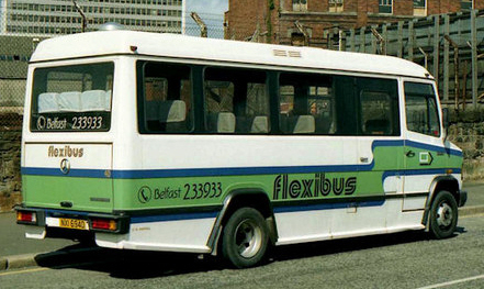
English: A Flexibus Mercedes minibus parked on the Laganbank Road, at the back of Oxford Street bus station. The area was subsequently redeveloped as Lanyon Quay. This part of the Laganbank Road ceased to exist. J3474 : Lanyon Quay, Belfast (2) shows (approximately) the same view, 21 years later, in 2011. |
| Date | |
| Source | Crop of File:Flexibus, Belfast (1990) - geograph.org.uk - 2661221.jpg |
| Author | Albert Bridge (original), cropped by User:Ultra7 |
| Permission (Reusing this file) |
Creative Commons Attribution Share-alike license 2.0 |
| Other versions |
_-_geograph.org.uk_-_2661221.jpg)
_-_geograph.org.uk_-_2661221_crop.jpg&action=edit§ion=1)
| Camera location | | View this and other nearby images on: OpenStreetMap |
|---|
_-_geograph.org.uk_-_2661221_crop.jpg¶ms=054.598512_N_-005.920882_E_globe:Earth_type:camera_heading:292.00&language=en)
Licensing
edit_-_geograph.org.uk_-_2661221_crop.jpg&action=edit§ion=2)
This file is licensed under the Creative Commons Attribution-Share Alike 2.0 Generic license.
Attribution: Albert Bridge
- You are free:
- to share – to copy, distribute and transmit the work
- to remix – to adapt the work
- Under the following conditions:
- attribution – You must give appropriate credit, provide a link to the license, and indicate if changes were made. You may do so in any reasonable manner, but not in any way that suggests the licensor endorses you or your use.
- share alike – If you remix, transform, or build upon the material, you must distribute your contributions under the same or compatible license as the original.
File history
Click on a date/time to view the file as it appeared at that time.
| Date/Time | Thumbnail | Dimensions | User | Comment | |
|---|---|---|---|---|---|
| current | 17:58, 12 May 2012 | | 441 × 263 (119 KB) | Ultra7 (talk | contribs) | == {{int:filedesc}} == {{Information |Description={{en|1=A Flexibus Mercedes minibus parked on the Laganbank Road, at the back of Oxford Street bus station. The area was subsequently redeveloped as Lanyon Quay. This part of the Laganbank Road ceased to... |
You cannot overwrite this file.
File usage on Commons
The following page uses this file:
_-_geograph.org.uk_-_2661221_crop.jpg&oldid=716163789)