File:Flooding in Brazil (MODIS).jpg

Original file (1,921 × 1,478 pixels, file size: 475 KB, MIME type: image/jpeg)
Captions
Captions
Summary
edit.jpg&action=edit§ion=1)
| Description |
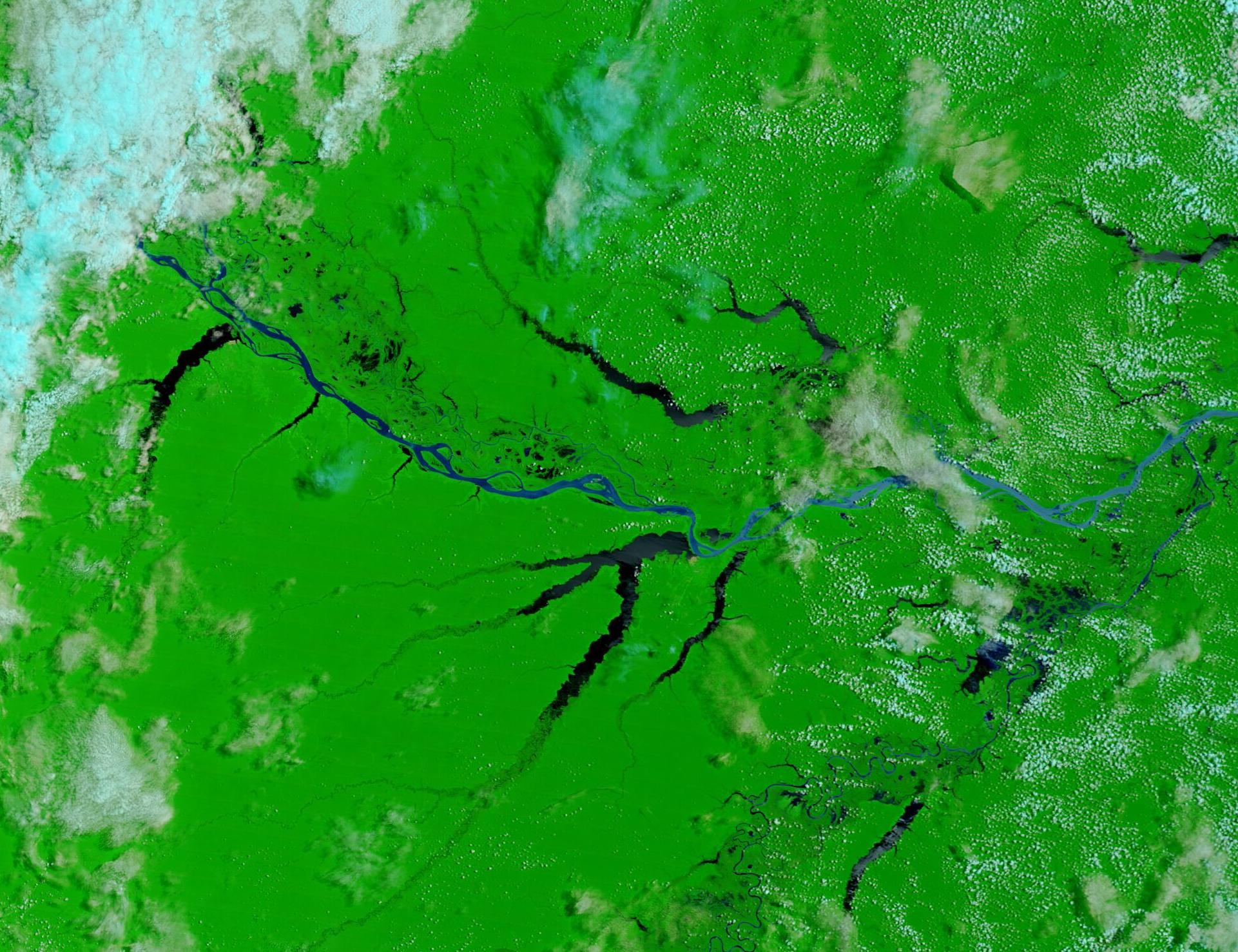
English: April 5, 2023 December 25, 2022
Extreme rains fell across northwestern Brazil in late March 2023, causing flooding and triggering landslides. The torrential rain brought at least 203 millimeters (8 inches) of rain in just three days to Rio Branco, the capital of the Acre state. That’s 75 percent of the rainfall expected in that area over the entire month of March. According to ReliefWeb, as of March 30 about 15,000 people had been displaced, and numerous homes and roads damaged. At least 172 of the homes were destroyed in Manaus, the capital of the state of Amazonas. The Negro and Solimões rivers meet just east of Manaus and join to form the Amazon River. The Solimões River is also sometimes called the upper Amazon River. The Moderate Resolution Imaging Spectroradiometer (MODIS) on board NASA’s Terra satellite acquired a false-color image centered on Amazonas, Brazil on April 5, 2023, and a second false-color image of the same area on December 25, 2022. Clicking on the dates under the image will permit toggling back and forth between the two images, and allow a comparison of the dramatic changes in the rivers of the region, including the large Amazon River, between the two dates. This type of false-color image, which uses MODIS bands 7, 2, and 1, is often used to help separate water from surrounding vegetation or open land. Water appears blue, vegetation is green, and open land is tan. Clouds usually appear white, although high, cold clouds may carry a tint of bright blue. The town of Coari sits near the center of this image, close to where the bright blue waters of the Amazon River dips southward. The darker water near that location are all flooded lakes. Although the clouds were nearly-cloud free on April 5, when the most recent image was acquired, thunderstorms are forecast from April 8-20. |
||
| Date | Taken on 5 April 2023 | ||
| Source |
Flooding in Brazil (direct link)
|
||
| Author | MODIS Land Rapid Response Team, NASA GSFC |
| This media is a product of the Terra mission Credit and attribution belongs to the mission team, if not already specified in the "author" row |
Licensing
edit.jpg&action=edit§ion=2)
| This file is in the public domain in the United States because it was solely created by NASA. NASA copyright policy states that "NASA material is not protected by copyright unless noted". (See Template:PD-USGov, NASA copyright policy page or JPL Image Use Policy.) | ||
 |
Warnings:
|
File history
Click on a date/time to view the file as it appeared at that time.
| Date/Time | Thumbnail | Dimensions | User | Comment | |
|---|---|---|---|---|---|
| current | 19:59, 31 July 2023 | | 1,921 × 1,478 (475 KB) | OptimusPrimeBot (talk | contribs) | #Spacemedia - Upload of http://modis.gsfc.nasa.gov/gallery/images/image04072023_250m.jpg via Commons:Spacemedia |
You cannot overwrite this file.
File usage on Commons
There are no pages that use this file.
.jpg&oldid=831980437)