File:Flooding on the Songhua River, Eastern China (MODIS 2020-10-19).jpg

Original file (3,242 × 2,671 pixels, file size: 1.05 MB, MIME type: image/jpeg)
Captions
Captions
Summary
edit.jpg&action=edit§ion=1)
| Description |
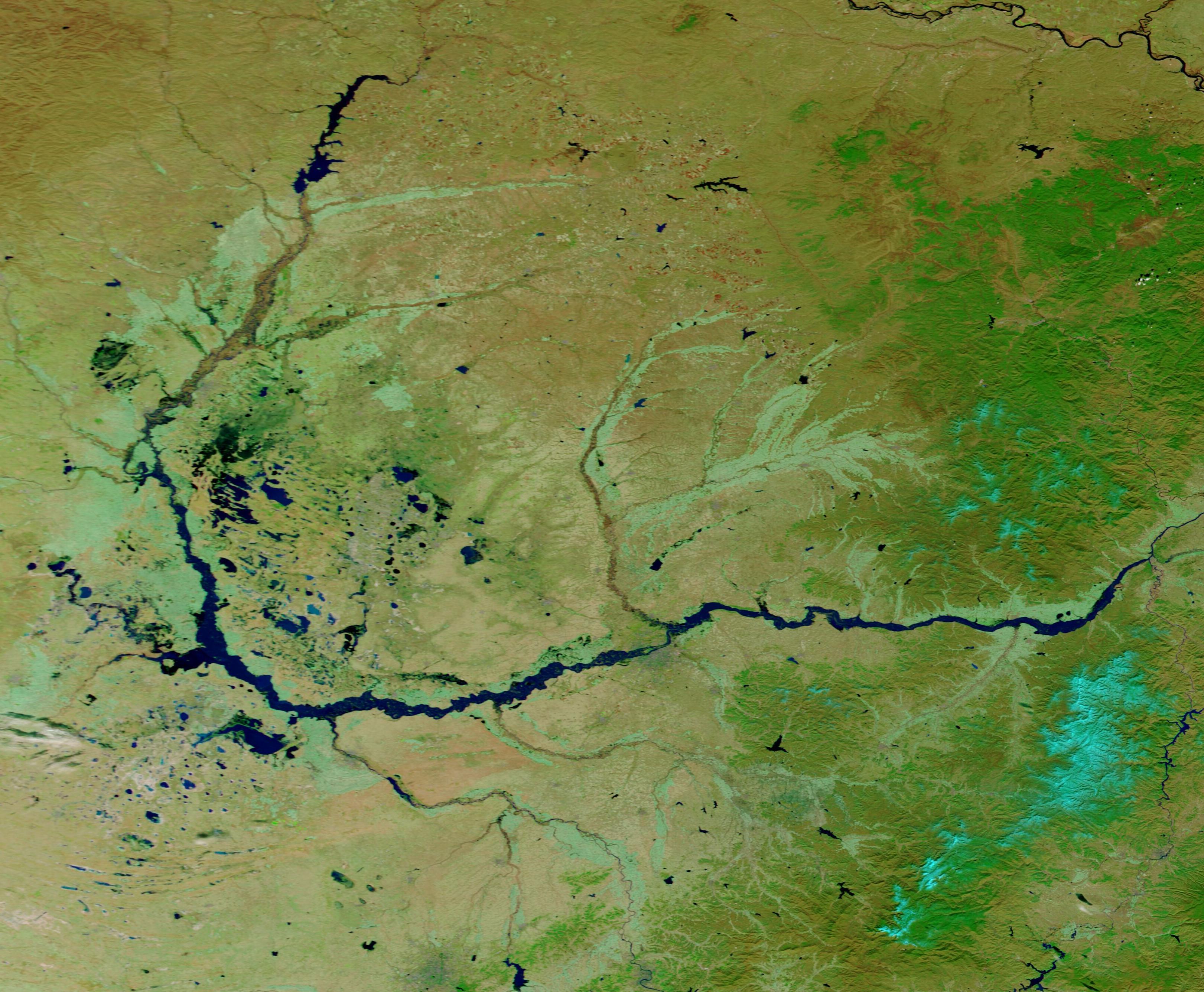
English: On October 13, 2020, the Moderate Resolution Imaging Spectroradiometer (MODIS) on board NASA’s Terra satellite acquired a striking false-color image of flooding along the Songhua River. Nearby rivers were also swollen, including the Nen River (west) which curves eastward to meet the flooded Songhua River. Other tributaries of the Songhua also appear above flood stage, including the Di’er Songhua and Lalin rivers, in the south.
This false-color image uses infrared and visible light (MODIS bands 7,2,1) to help separate water from land and vegetation. Vegetation appears bright green, water is deep blue, bare land appears tan, and clouds appear white and light blue. While a single image shows the situation on a specific day, a comparison of two different days can better illustrate the changes caused by flooding. Thanks to the NASA Worldview App, it is easy to view a roll-over comparison of two Terra MODIS images. To view the comparison of the image above, acquired October 15, to an image of the same area acquired on July 10, 2020, click here. The NASA Worldview app provides a satellite's perspective of the planet as it looks today and as it has in the past through daily satellite images. Worldview is part of NASA’s Earth Observing System Data and Information System. EOSDIS makes the agency's large repository of data accessible and freely available to the public. |
||
| Date | Taken on 15 October 2020 | ||
| Source |
Flooding on the Songhua River, Eastern China (direct link)
|
||
| Author | MODIS Land Rapid Response Team, NASA GSFC |
| This media is a product of the Terra mission Credit and attribution belongs to the mission team, if not already specified in the "author" row |
Licensing
edit.jpg&action=edit§ion=2)
| This file is in the public domain in the United States because it was solely created by NASA. NASA copyright policy states that "NASA material is not protected by copyright unless noted". (See Template:PD-USGov, NASA copyright policy page or JPL Image Use Policy.) | ||
 |
Warnings:
|
File history
Click on a date/time to view the file as it appeared at that time.
| Date/Time | Thumbnail | Dimensions | User | Comment | |
|---|---|---|---|---|---|
| current | 19:48, 7 February 2024 | | 3,242 × 2,671 (1.05 MB) | OptimusPrimeBot (talk | contribs) | #Spacemedia - Upload of http://modis.gsfc.nasa.gov/gallery/images/image10192020_250m.jpg via Commons:Spacemedia |
You cannot overwrite this file.
File usage on Commons
There are no pages that use this file.
.jpg&oldid=849872720)