File:Florian Thiery UCC.jpg

Size of this preview: 416 × 599 pixels. Other resolutions: 166 × 240 pixels | 333 × 480 pixels | 533 × 768 pixels | 711 × 1,024 pixels | 2,267 × 3,266 pixels.
Original file (2,267 × 3,266 pixels, file size: 2.28 MB, MIME type: image/jpeg)
Captions
Captions
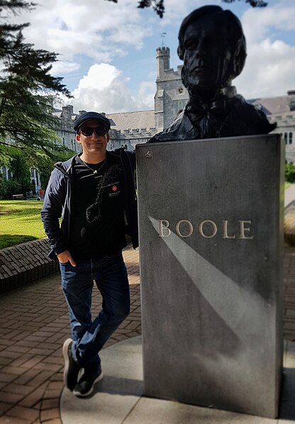
Florian Thiery is a Geodesist and Research Software Engineer.
Summary edit
| Description |
Deutsch: Florian Thiery ist ein Geodät und Research Software Engineer. Das Foto wurde während einer Reise zu Ogham Steinen an der UCC in Cork aufgenommen.
English: Florian Thiery is a Geodesist and Research Software Engineer. Foto was taken during a trip to ogham stones at UCC Cork. |
| Date | |
| Source | Own work |
| Author | Florian Thiery |
| Camera location | | View this and other nearby images on: OpenStreetMap |
|---|
Licensing edit
I, the copyright holder of this work, hereby publish it under the following license:
This file is licensed under the Creative Commons Attribution-Share Alike 4.0 International license.
- You are free:
- to share – to copy, distribute and transmit the work
- to remix – to adapt the work
- Under the following conditions:
- attribution – You must give appropriate credit, provide a link to the license, and indicate if changes were made. You may do so in any reasonable manner, but not in any way that suggests the licensor endorses you or your use.
- share alike – If you remix, transform, or build upon the material, you must distribute your contributions under the same or compatible license as the original.
File history
Click on a date/time to view the file as it appeared at that time.
| Date/Time | Thumbnail | Dimensions | User | Comment | |
|---|---|---|---|---|---|
| current | 14:47, 23 September 2020 | | 2,267 × 3,266 (2.28 MB) | Fthierygeo (talk | contribs) | Uploaded own work with UploadWizard |
You cannot overwrite this file.
File usage on Commons
The following 2 pages use this file:
File usage on other wikis
The following other wikis use this file:
- Usage on de.wikipedia.org
- Usage on de.wikiversity.org
- Usage on en.wikipedia.org
- Usage on www.wikidata.org