File:Flying Bomb - Railway Bridge, Grove Road, Bow, Tower Hamlets, E3.JPG

Size of this preview: 450 × 600 pixels. Other resolutions: 180 × 240 pixels | 360 × 480 pixels | 576 × 768 pixels | 768 × 1,024 pixels | 1,536 × 2,048 pixels | 3,456 × 4,608 pixels.
Original file (3,456 × 4,608 pixels, file size: 3.34 MB, MIME type: image/jpeg)
Captions
Captions
Add a one-line explanation of what this file represents
Summary edit
| Description |
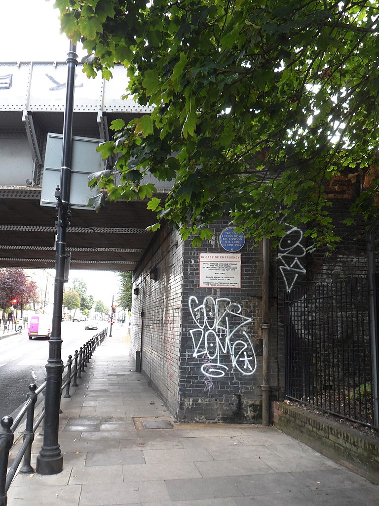
English: Site of Blue plaque erected in 1988 by English Heritage at Railway Bridge, Grove Road, Bow, London E3, London Borough of Tower Hamlets. |
| Date | |
| Source | Own work |
| Author | Spudgun67 |
| Camera location | | View this and other nearby images on: OpenStreetMap |
|---|
THE FIRST FLYING BOMB ON LONDON FELL HERE 13 JUNE 1944. Eight civilians were killed in the blast. Replaces the plaque erected by the GLC in 1985 and subsequently stolen. openplaques:id=530
Licensing edit
I, the copyright holder of this work, hereby publish it under the following license:
This file is licensed under the Creative Commons Attribution-Share Alike 4.0 International license.
- You are free:
- to share – to copy, distribute and transmit the work
- to remix – to adapt the work
- Under the following conditions:
- attribution – You must give appropriate credit, provide a link to the license, and indicate if changes were made. You may do so in any reasonable manner, but not in any way that suggests the licensor endorses you or your use.
- share alike – If you remix, transform, or build upon the material, you must distribute your contributions under the same or compatible license as the original.
File history
Click on a date/time to view the file as it appeared at that time.
| Date/Time | Thumbnail | Dimensions | User | Comment | |
|---|---|---|---|---|---|
| current | 23:13, 24 November 2014 | | 3,456 × 4,608 (3.34 MB) | Spudgun67 (talk | contribs) | User created page with UploadWizard |
You cannot overwrite this file.
File usage on Commons
There are no pages that use this file.