File:Foel y Geifr 381365.jpg
No higher resolution available.
Foel_y_Geifr_381365.jpg (640 × 396 pixels, file size: 45 KB, MIME type: image/jpeg)
Captions
Captions
Add a one-line explanation of what this file represents
Summary edit
| Description |
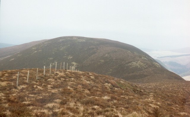
English: At spot height 612 metres, 4 km from Ty-Nant, Gwynedd, Great Britain.
The minor top called Trum y Gwragedd from the slopes of Foel y Geifr. |
| Date | |
| Source | From this image at geograph.org.uk; transferred by User:RHaworth using geograph_org2commons. |
| Author | Dewi |
| Permission (Reusing this file) |
Creative Commons Attribution Share-alike license 2.0 |
| Attribution (required by the license) | Dewi / .612 / |
| Camera location | | View this and other nearby images on: OpenStreetMap |
|---|
| Object location | | View this and other nearby images on: OpenStreetMap |
|---|
_region:GB-GBN_heading:22.00&language=en)
Licensing edit

|
This image was taken from the Geograph project collection. See this photograph's page on the Geograph website for the photographer's contact details. The copyright on this image is owned by Dewi and is licensed for reuse under the Creative Commons Attribution-ShareAlike 2.0 license.
|
This file is licensed under the Creative Commons Attribution-Share Alike 2.0 Generic license.
Attribution: Dewi
- You are free:
- to share – to copy, distribute and transmit the work
- to remix – to adapt the work
- Under the following conditions:
- attribution – You must give appropriate credit, provide a link to the license, and indicate if changes were made. You may do so in any reasonable manner, but not in any way that suggests the licensor endorses you or your use.
- share alike – If you remix, transform, or build upon the material, you must distribute your contributions under the same or compatible license as the original.
File history
Click on a date/time to view the file as it appeared at that time.
| Date/Time | Thumbnail | Dimensions | User | Comment | |
|---|---|---|---|---|---|
| current | 18:31, 8 April 2010 | | 640 × 396 (45 KB) | File Upload Bot (Magnus Manske) (talk | contribs) | == {{int:filedesc}} == {{Information |Description={{en|1=.612, 4 km from Ty-Nant, Gwynedd, Great Britain. The minor top called Trum y Gwragedd from the slopes of Foel y Geifr.}} |Source=From [http://www.geograph.org.uk/photo/381365 this image] at [http:// |
You cannot overwrite this file.
File usage on Commons
The following 2 pages use this file:
- File:.612 - geograph.org.uk - 381365.jpg (file redirect)
- Category:Trum y Gwragedd
File usage on other wikis
The following other wikis use this file:
- Usage on cy.wikipedia.org
- Usage on en.wikipedia.org
- Usage on www.wikidata.org