File:Footpath by Amberley Station - geograph.org.uk - 545287.jpg
No higher resolution available.
Footpath_by_Amberley_Station_-_geograph.org.uk_-_545287.jpg (640 × 480 pixels, file size: 131 KB, MIME type: image/jpeg)
Captions
Captions
Add a one-line explanation of what this file represents
Summary
edit
| Description |
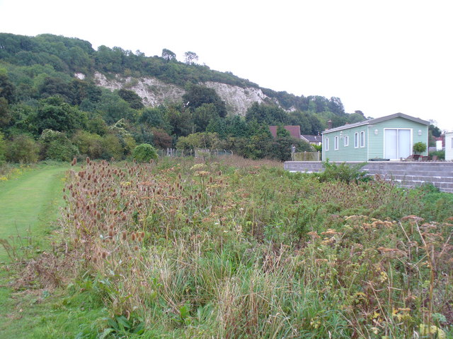
English: Footpath by Amberley Station This path passes an extensive patch of spiky teazels, a plant formerly used for raising the nap on cloth. To the right is a trailer park by the banks of the Arun and in the distance is a chalk cliff which overlooks the river. |
| Date | |
| Source | From geograph.org.uk |
| Author | Colin Smith |
| Attribution (required by the license) | Colin Smith / Footpath by Amberley Station / |
| Camera location | | View this and other nearby images on: OpenStreetMap |
|---|
_heading:157.00&language=en)
| Object location | | View this and other nearby images on: OpenStreetMap |
|---|
_heading:157.00&language=en)
Licensing
edit

|
This image was taken from the Geograph project collection. See this photograph's page on the Geograph website for the photographer's contact details. The copyright on this image is owned by Colin Smith and is licensed for reuse under the Creative Commons Attribution-ShareAlike 2.0 license.
|
This file is licensed under the Creative Commons Attribution-Share Alike 2.0 Generic license.
Attribution: Colin Smith
- You are free:
- to share – to copy, distribute and transmit the work
- to remix – to adapt the work
- Under the following conditions:
- attribution – You must give appropriate credit, provide a link to the license, and indicate if changes were made. You may do so in any reasonable manner, but not in any way that suggests the licensor endorses you or your use.
- share alike – If you remix, transform, or build upon the material, you must distribute your contributions under the same or compatible license as the original.
File history
Click on a date/time to view the file as it appeared at that time.
| Date/Time | Thumbnail | Dimensions | User | Comment | |
|---|---|---|---|---|---|
| current | 23:26, 5 February 2011 | | 640 × 480 (131 KB) | GeographBot (talk | contribs) | == {{int:filedesc}} == {{Information |description={{en|1=Footpath by Amberley Station This path passes an extensive patch of spiky teazels, a plant formerly used for raising the nap on cloth. To the right is a trailer park by the banks of the Arun and in |
You cannot overwrite this file.
File usage on Commons
There are no pages that use this file.