File:Footpath to Northeye - geograph.org.uk - 1744629.jpg
Size of this preview: 800 × 600 pixels. Other resolutions: 320 × 240 pixels | 640 × 480 pixels | 1,024 × 768 pixels.
Original file (1,024 × 768 pixels, file size: 200 KB, MIME type: image/jpeg)
Captions
Captions
Add a one-line explanation of what this file represents
Summary
edit
| Description |
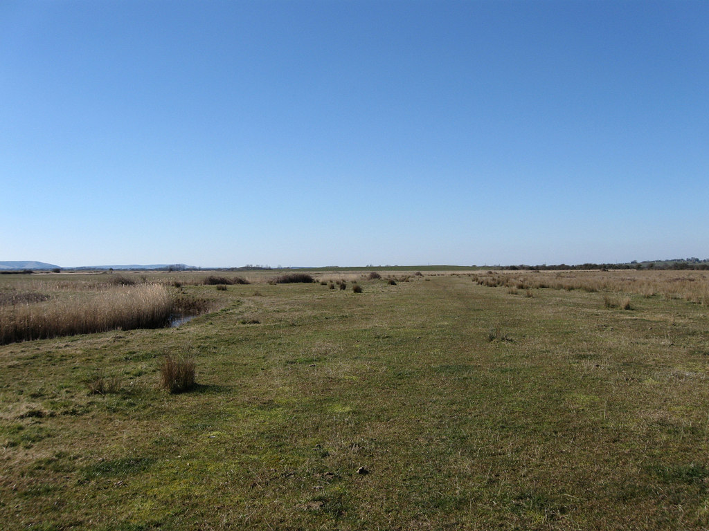
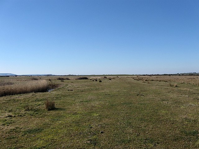
English: Footpath to Northeye A right of way known locally as a trade that dates back to the 12th century when the land here was reclaimed and for workers of both the maintenance of the dykes and sea walls as well as the cereal producing fields from the nearby villages of Barnhorne and Northeye. Neither villages exist anymore, the latter was located on the slight rise of ground in the distance and was a small port, both having disappeared by the 15th century. With depopulation and cereal production giving way to sheep pasturing the levels feel very isolated once more and only a set of footpaths left to remind you of a thriving community that once existed here. |
| Date | |
| Source | From geograph.org.uk |
| Author | Simon Carey |
| Attribution (required by the license) | Simon Carey / Footpath to Northeye / |
| Camera location | | View this and other nearby images on: OpenStreetMap |
|---|
_heading:292.00&language=en)
| Object location | | View this and other nearby images on: OpenStreetMap |
|---|
_heading:292.00&language=en)
Licensing
edit

|
This image was taken from the Geograph project collection. See this photograph's page on the Geograph website for the photographer's contact details. The copyright on this image is owned by Simon Carey and is licensed for reuse under the Creative Commons Attribution-ShareAlike 2.0 license.
|
This file is licensed under the Creative Commons Attribution-Share Alike 2.0 Generic license.
Attribution: Simon Carey
- You are free:
- to share – to copy, distribute and transmit the work
- to remix – to adapt the work
- Under the following conditions:
- attribution – You must give appropriate credit, provide a link to the license, and indicate if changes were made. You may do so in any reasonable manner, but not in any way that suggests the licensor endorses you or your use.
- share alike – If you remix, transform, or build upon the material, you must distribute your contributions under the same or compatible license as the original.

|
The categories of this image need checking. You can do so here.
|
File history
Click on a date/time to view the file as it appeared at that time.
| Date/Time | Thumbnail | Dimensions | User | Comment | |
|---|---|---|---|---|---|
| current | 18:57, 5 March 2011 | | 1,024 × 768 (200 KB) | GeographBot (talk | contribs) | == {{int:filedesc}} == {{Information |description={{en|1=Footpath to Northeye A right of way known locally as a trade that dates back to the 12th century when the land here was reclaimed and for workers of both the maintenance of the dykes and sea walls a |
You cannot overwrite this file.
File usage on Commons
There are no pages that use this file.