File:Foreign factories, 1840.jpg
Original file (2,694 × 2,434 pixels, file size: 2.2 MB, MIME type: image/jpeg)
Captions
Captions
Summary
edit| Artist |
W. Bramston, engraved by James Wyld |
| Author |
Published by Jas. Wyld, Geographer to the Queen, Charing Cross, East London. Enterered at Stationer's Hall. |
| Description |
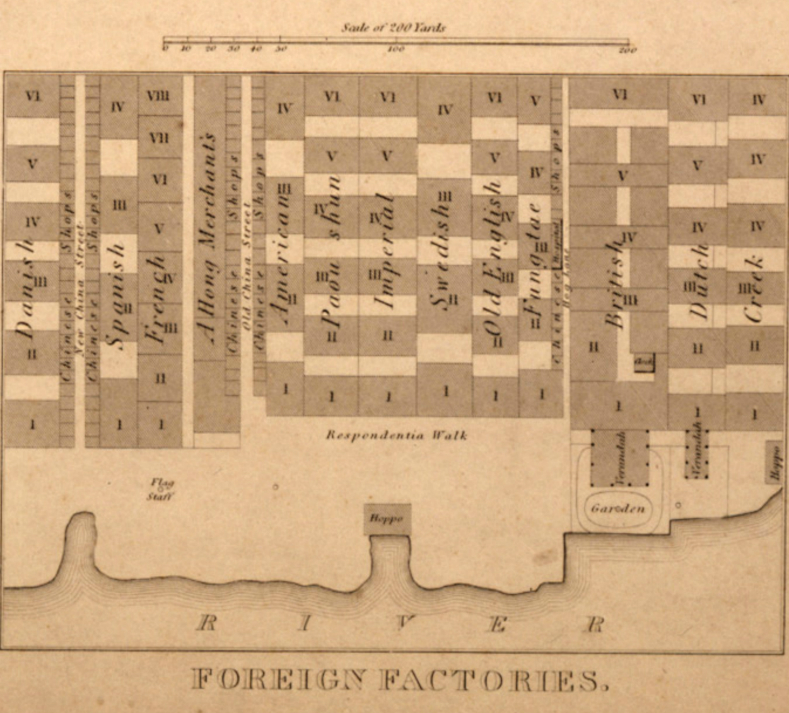
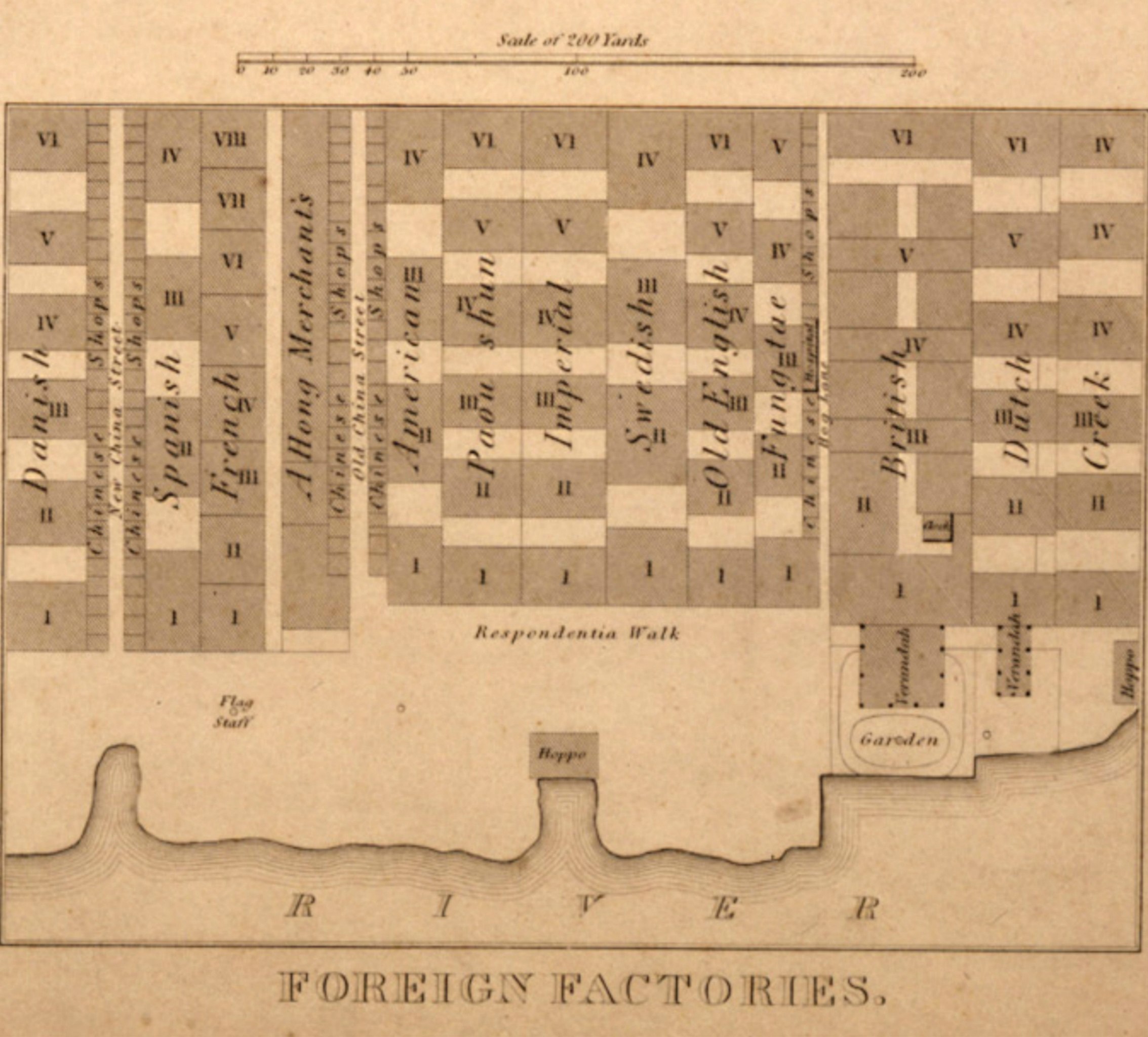
English: Map of the Thirteen Factories of Guangzhou in the Qing Empire in 1840, prior to their destruction by fire the next year during the First Opium War. "Imperial" refers to the Austrian Empire. |
| Date | 1840 |
| Source/Photographer | MIT |
| Other versions |
|


Licensing
edit
|
This work is in the public domain in its country of origin and other countries and areas where the copyright term is the author's life plus 70 years or fewer.
| |
| This file has been identified as being free of known restrictions under copyright law, including all related and neighboring rights. | |
| Annotations | This image is annotated: View the annotations at Commons |
File history
Click on a date/time to view the file as it appeared at that time.
| Date/Time | Thumbnail | Dimensions | User | Comment | |
|---|---|---|---|---|---|
| current | 19:14, 3 July 2016 | | 2,694 × 2,434 (2.2 MB) | LlywelynII (talk | contribs) | Cropping out completely unrelated legends to separate map |
| 18:50, 3 July 2016 | 3,362 × 1,366 (2.26 MB) | LlywelynII (talk | contribs) | Copping out name of completely unaffiliated island | ||
| 07:16, 2 May 2010 |  | 1,681 × 800 (374 KB) | Spellcast (talk | contribs) | == {{int:filedesc}} == {{Information |Description={{en|Map of the foreign factories in Canton. Part of File:British map of Canton, 1840.jpg}} |Date=1840 |Source=http://ocw.mit.edu/ans7870/21f/21f.027/rise_fall_canton_03/canton.html |Author=W. Bramsto |
You cannot overwrite this file.
File usage on Commons
The following 3 pages use this file:
File usage on other wikis
The following other wikis use this file:
- Usage on en.wikipedia.org
- Usage on es.wikipedia.org
- Usage on id.wikipedia.org
- Usage on it.wikipedia.org
- Usage on tr.wikipedia.org
- Usage on zh-yue.wikipedia.org