File:Former Gospel Protestant Mission Hall, East Grinstead.JPG

Size of this preview: 800 × 582 pixels. Other resolutions: 320 × 233 pixels | 640 × 465 pixels | 1,024 × 745 pixels | 1,280 × 931 pixels | 2,200 × 1,600 pixels.
Original file (2,200 × 1,600 pixels, file size: 1.16 MB, MIME type: image/jpeg)
Captions
Captions
Add a one-line explanation of what this file represents
Summary
edit
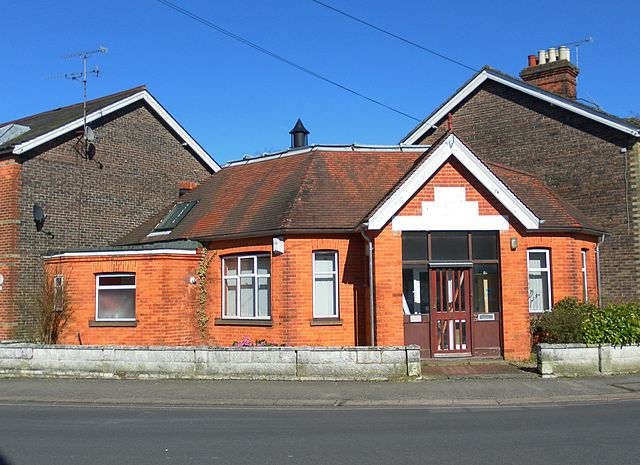
| Description | Former Gospel Protestant Mission Hall, De La Warr Road, East Grinstead, Mid Sussex District, West Sussex, England. Formerly a Countess of Huntingdon's Connexion chapel and the headquarters of that denomination. It was in religious use by the 1920s and survived until the 1970s. |
| Date | |
| Source | Own work |
| Author | The Voice of Hassocks |
| Openstreetmap entry | Link to Openstreetmap |
| Object location | | View this and other nearby images on: OpenStreetMap |
|---|
Licensing
edit
I, the copyright holder of this work, hereby publish it under the following license:
| This file is made available under the Creative Commons CC0 1.0 Universal Public Domain Dedication. | |
| The person who associated a work with this deed has dedicated the work to the public domain by waiving all of their rights to the work worldwide under copyright law, including all related and neighboring rights, to the extent allowed by law. You can copy, modify, distribute and perform the work, even for commercial purposes, all without asking permission.
|
File history
Click on a date/time to view the file as it appeared at that time.
| Date/Time | Thumbnail | Dimensions | User | Comment | |
|---|---|---|---|---|---|
| current | 22:36, 19 March 2011 | | 2,200 × 1,600 (1.16 MB) | Hassocks5489 (talk | contribs) | == Summary == {{Information |Description=Former Gospel Protestant Mission Hall, De La Warr Road, East Grinstead, Mid Sussex District, West Sussex, England. Formerly a Countess of Huntingdon's Connexion chapel and the headquarters of that denomination. I |
You cannot overwrite this file.
File usage on Commons
The following page uses this file:
File usage on other wikis
The following other wikis use this file:
- Usage on en.wikipedia.org