File:Former Possil Station building (geograph 5300227).jpg
Size of this preview: 800 × 513 pixels. Other resolutions: 320 × 205 pixels | 640 × 410 pixels | 1,024 × 656 pixels | 1,280 × 820 pixels | 1,600 × 1,025 pixels.
Original file (1,600 × 1,025 pixels, file size: 264 KB, MIME type: image/jpeg)
Captions
Captions
Add a one-line explanation of what this file represents
Summary
edit.jpg&action=edit§ion=1)
| Description |
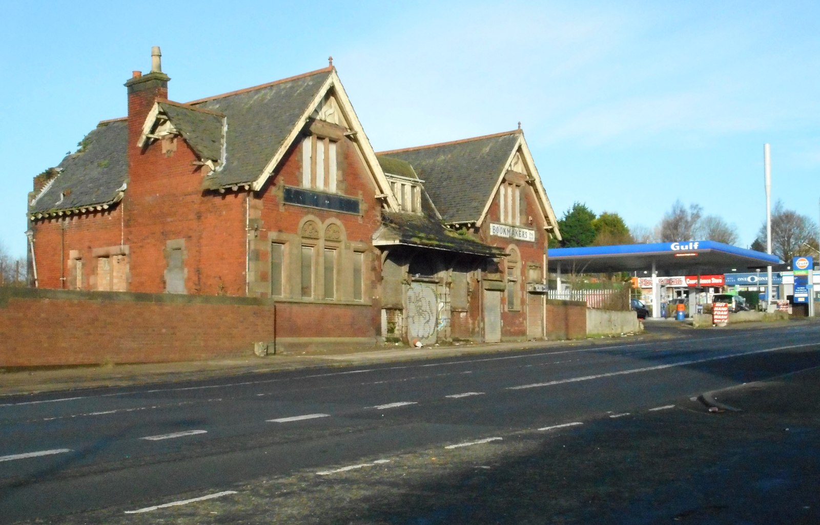
English: Former Possil Station building A Category C listed building, built facing onto Balmore Road, above the railway lines which formerly ran east to west under the road. Built in 1897 for the Lanarkshire and Dumbarton Railway, the station finally closed in 1964. Now in very poor condition, it is listed on the Buildings at Risk Register. |
| Date | |
| Source | From geograph.org.uk |
| Author | Richard Sutcliffe |
| Permission (Reusing this file) |
Creative Commons Attribution Share-alike license 2.0 |
| Attribution (required by the license) | Richard Sutcliffe / Former Possil Station building / |
| Camera location | | View this and other nearby images on: OpenStreetMap |
|---|
.jpg¶ms=055.891831_N_-004.259570_E_globe:Earth_type:camera_source:geograph-osgb36(NS58796883)_heading:292.00&language=en)
| Object location | | View this and other nearby images on: OpenStreetMap |
|---|
.jpg¶ms=055.892000_N_-004.260060_E_globe:Earth_class:object_type:object_source:geograph-osgb36(NS58766885)_heading:292.00&language=en)
Licensing
edit.jpg&action=edit§ion=2)

|
This image was taken from the Geograph project collection. See this photograph's page on the Geograph website for the photographer's contact details. The copyright on this image is owned by Richard Sutcliffe and is licensed for reuse under the Creative Commons Attribution-ShareAlike 2.0 license.
|
This file is licensed under the Creative Commons Attribution-Share Alike 2.0 Generic license.
Attribution: Richard Sutcliffe
- You are free:
- to share – to copy, distribute and transmit the work
- to remix – to adapt the work
- Under the following conditions:
- attribution – You must give appropriate credit, provide a link to the license, and indicate if changes were made. You may do so in any reasonable manner, but not in any way that suggests the licensor endorses you or your use.
- share alike – If you remix, transform, or build upon the material, you must distribute your contributions under the same or compatible license as the original.
File history
Click on a date/time to view the file as it appeared at that time.
| Date/Time | Thumbnail | Dimensions | User | Comment | |
|---|---|---|---|---|---|
| current | 13:05, 6 January 2019 | | 1,600 × 1,025 (264 KB) | Crowsus (talk | contribs) | Transferred from geograph.co.uk using [https://tools.wmflabs.org/geograph2commons/ geograph2commons] |
You cannot overwrite this file.
File usage on Commons
The following page uses this file:
.jpg&oldid=740376528)