File:Former route of the Boa Entrada narrow gauge railway of 1958 superimposed onto OpenStreetMap map.jpg

Size of this preview: 800 × 537 pixels. Other resolutions: 320 × 215 pixels | 640 × 429 pixels | 1,024 × 687 pixels | 1,280 × 859 pixels | 1,568 × 1,052 pixels.
Original file (1,568 × 1,052 pixels, file size: 414 KB, MIME type: image/jpeg)
Captions
Captions
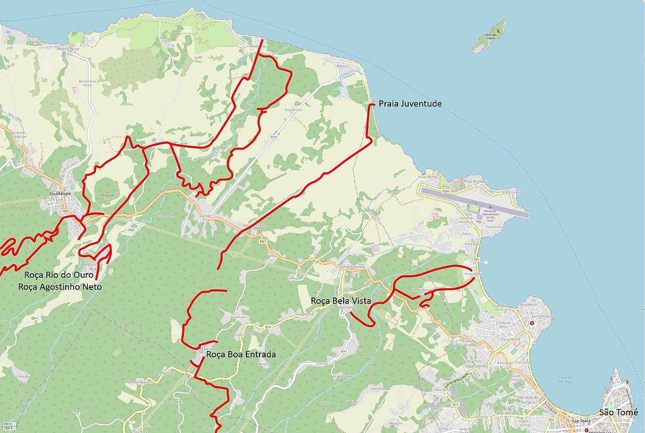
Former route of the Boa Entrada narrow gauge railway of 1958 superimposed onto OpenStreetMap map
Summary
edit
| Description |
English: Former route of the Boa Entrada narrow gauge railway of 1958 superimposed onto OpenStreetMap map |
| Date | and 2022 |
| Source | |
| Author |
|
Licensing
edit
This file is licensed under the Creative Commons Attribution-Share Alike 2.5 Generic license.
- You are free:
- to share – to copy, distribute and transmit the work
- to remix – to adapt the work
- Under the following conditions:
- attribution – You must give appropriate credit, provide a link to the license, and indicate if changes were made. You may do so in any reasonable manner, but not in any way that suggests the licensor endorses you or your use.
- share alike – If you remix, transform, or build upon the material, you must distribute your contributions under the same or compatible license as the original.
File history
Click on a date/time to view the file as it appeared at that time.
| Date/Time | Thumbnail | Dimensions | User | Comment | |
|---|---|---|---|---|---|
| current | 11:36, 10 September 2022 | | 1,568 × 1,052 (414 KB) | NearEMPTiness (talk | contribs) | Version 1.02 |
| 16:05, 8 September 2022 |  | 1,564 × 1,040 (414 KB) | NearEMPTiness (talk | contribs) | Uploaded a work by * OpenStreetMap Contributors * Junta de Investigações do Ultramar: Topographic Map, 1:25000. Ministério das Colónias, 1958. * NearEMPTiness from *https://www.openstreetmap.org/?mlat=0.262005&mlon=6.701953&zoom=11#map=14/0.3688/6.6854 *https://gpixel.org/q/m/st/yndex.php#zoom=2.4762914&x=0.7245037&y=0.1650939 with UploadWizard |
You cannot overwrite this file.
File usage on Commons
There are no pages that use this file.
File usage on other wikis
The following other wikis use this file:
- Usage on de.wikipedia.org