File:Former route of the narrow gauge railway at Baidaihe (北戴河附近的窄轨铁路) superimposed onto OpenStreetMap map.jpg
Size of this preview: 800 × 417 pixels. Other resolutions: 320 × 167 pixels | 640 × 333 pixels | 1,024 × 533 pixels | 1,528 × 796 pixels.
Original file (1,528 × 796 pixels, file size: 296 KB, MIME type: image/jpeg)
Captions
Captions
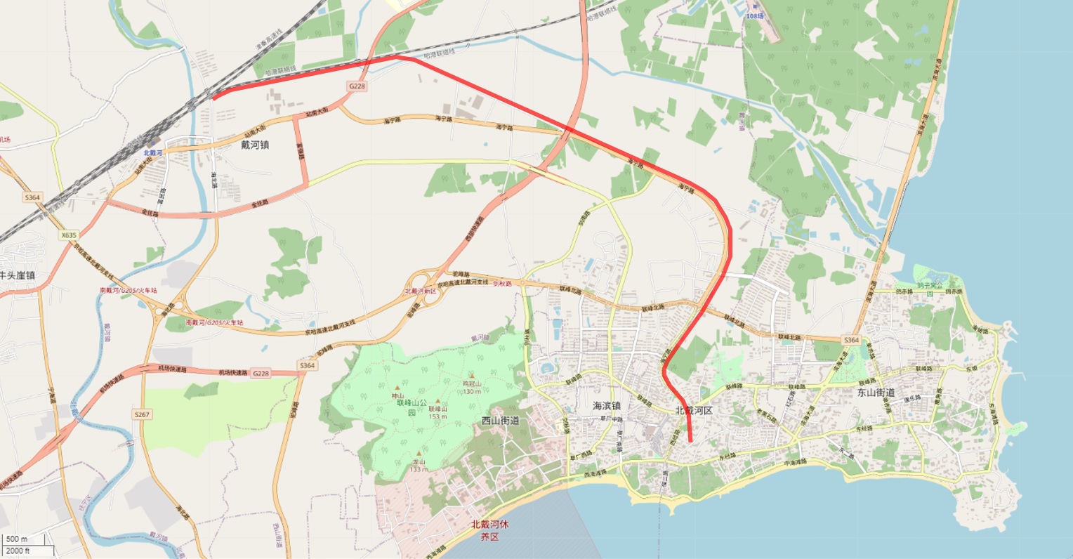
Former route of the narrow gauge railway at Baidaihe
Summary
edit_superimposed_onto_OpenStreetMap_map.jpg&action=edit§ion=1)
| Description |
English: Former route of the narrow gauge railway at Baidaihe (北戴河附近的窄轨铁路) superimposed onto OpenStreetMap map |
| Date | |
| Source | |
| Author |
|
Licensing
edit_superimposed_onto_OpenStreetMap_map.jpg&action=edit§ion=2)
| Description |
This map was created from OpenStreetMap project data, collected by the community. This map may be incomplete, and may contain errors. Don't rely solely on it for navigation. |
|||
| Date | (see file history) | |||
| Source | openstreetmap.org | |||
| Creator |
OpenStreetMap contributors |
|||
| Permission (Reusing this file) |
OpenStreetMap data is available under the Open Database License (details). Map tiles are licensed under the Creative Commons Attribution-ShareAlike 2.0 license (CC-BY-SA 2.0).
This file is licensed under the Creative Commons Attribution-Share Alike 2.0 Generic license.
|
|||
| Georeferencing | If inappropriate please set warp_status = skip to hide. |
File history
Click on a date/time to view the file as it appeared at that time.
| Date/Time | Thumbnail | Dimensions | User | Comment | |
|---|---|---|---|---|---|
| current | 12:00, 19 August 2022 | | 1,528 × 796 (296 KB) | NearEMPTiness (talk | contribs) | Uploaded a work by *OpenStreetMap Contributors *NearEMPTiness, based on a US military map drawn in 1930ies from *https://www.openstreetmap.org/#map=14/39.8471/119.5027 *https://zhuanlan.zhihu.com/p/463300333 with UploadWizard |
You cannot overwrite this file.
File usage on Commons
There are no pages that use this file.
File usage on other wikis
The following other wikis use this file:
- Usage on de.wikipedia.org
_superimposed_onto_OpenStreetMap_map.jpg&oldid=883434939)